
Archivo: Portland aerial tram roads and route

Tamaño de esta previsualización: 620 × 600 píxeles. Otras resoluciones: 248 × 240 píxeles | 1489 × 1440 píxeles.
Archivo original (1489 × 1440 píxeles; tamaño de archivo: 406 KB; tipo MIME: image/png)
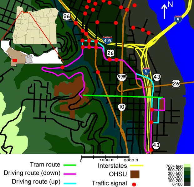
Description: Diagram of Portland Aerial Tram route contrasted with surface transport routes. This revision cleans up some highway icons, and places Hwy 10 on the correct highway, and attempts to clarify the inset's context. Barbur Blvd north of the intersection with Front Ave. apparently has no highway designation.
Title: Portland aerial tram roads and route
Credit: Own work
Author: EncMstr
Usage Terms: Creative Commons Attribution-Share Alike 3.0
License: CC BY-SA 3.0
License Link: https://creativecommons.org/licenses/by-sa/3.0
Attribution Required?: Yes
Usos del archivo
La siguiente página enlaza a este archivo:

Todo el contenido de los artículos de la Enciclopedia Kiddle (incluidas las imágenes) se puede utilizar libremente para fines personales y educativos bajo la licencia Atribución-CompartirIgual a menos que se indique lo contrario.