
Archivo: Political map of England 1140

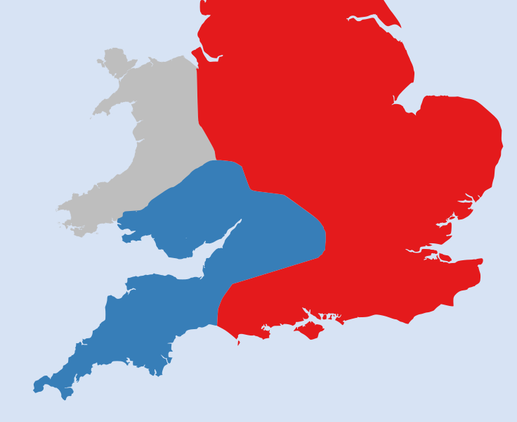
Descripción: A political map of England in 1140, based on data in Jim Bradbury's book "Stephen and Matilda", p.89 and p.180. The original map was a blank locator map for Great Britain. The idea is to superimpose Image:dot4gb.svg at the appropriate point. See w:Template:GBthumb for code to do this. These two images can replace any locator map posted by Lupin - see w:Special:Contributions/LupinBot. This is a vectorized version of Image:Gb4dot.png, with the scale changed from 200 km to 150 km/150 miles. The shoreline data come from the file gshhs_h.b from the GSHHS, and the rivers and the Irish border come from the CIA World DataBank II; both sources are in the public domain. Mercator projection.
Título: Political map of England 1140
Créditos: File:Political_map_of_England_1140.PNG
Autor(a): Hchc2009, rowanwindwhistler
Permiso: File:Political_map_of_England_1140.PNG
Términos de Uso: Creative Commons Attribution-Share Alike 4.0
Licencia: CC BY-SA 4.0
Enlace de Licencia: https://creativecommons.org/licenses/by-sa/4.0
¿Se exige la atribución?: Sí
Usos del archivo
Las siguientes páginas enlazan a este archivo:
