
Archivo: Piri Reis map interpretation RG
Tamaño de esta previsualización: 744 × 600 píxeles. Otras resoluciones: 298 × 240 píxeles | 800 × 645 píxeles.
Archivo original (800 × 645 píxeles; tamaño de archivo: 187 KB; tipo MIME: image/jpeg)
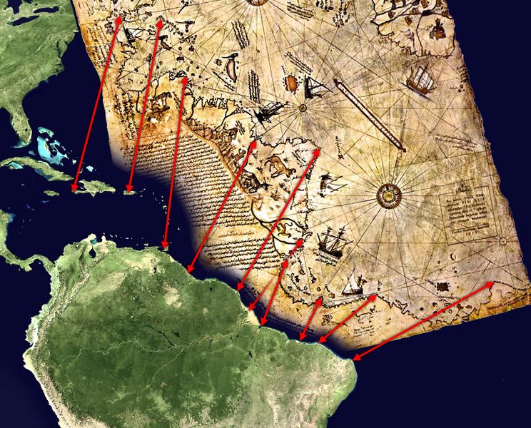
Description: Possible interpretation of the Piri Reis map. Middle and south america on the left, north africa in the upper right, south atlantic ocean in the middle. An alternate (and more likely) interpretation of those ancient map can be found here: File:Piri Reis map interpretation.jpg
Title: Piri Reis map interpretation RG
Credit: Own work, based on de:Datei:Karte des piri reis.jpg and File:Whole world - land and oceans.jpg. Both sources are public domain.
Author: TMg, based on an image by Segantini.
Usage Terms: Public domain
License: Public domain
Attribution Required?: No
Usos del archivo
Las siguientes páginas enlazan a este archivo:

Todo el contenido de los artículos de la Enciclopedia Kiddle (incluidas las imágenes) se puede utilizar libremente para fines personales y educativos bajo la licencia Atribución-CompartirIgual a menos que se indique lo contrario.