Archivo: Paricutin 30 612

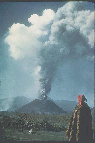
Description: Paricutin, Mexico;19.48 N 102.25 W;3,170 m elevation This slide shows the cinder cone soon after its birth in 1943 in a Mexican cornfield. During its brief nine-year lifespan (1943-1952), it built a 410-meter-high cone with extensive lava fields around the base of the cone. Most of the 2 km3 of eruptive products (ash, cinders, and lava) were produced in the first few years. Cinder cones such as this one are commonly formed by one eruption. Each subsequent eruption in the same area forms its own cinder cone.
Title: Paricutin 30 612
Credit: http://www.ngdc.noaa.gov/seg/hazard/slideset/30/30_612_slide.shtml
Author: Photo credit: K. Segerstrom, U.S. Geological Survey
Permission: PD-USGov-NOAA
Usage Terms: Public domain
License: Public domain
Attribution Required?: No
Usos del archivo
Las siguientes páginas enlazan a este archivo:

