
Archivo: Pacific Area - The Imperial Powers 1939 - Map
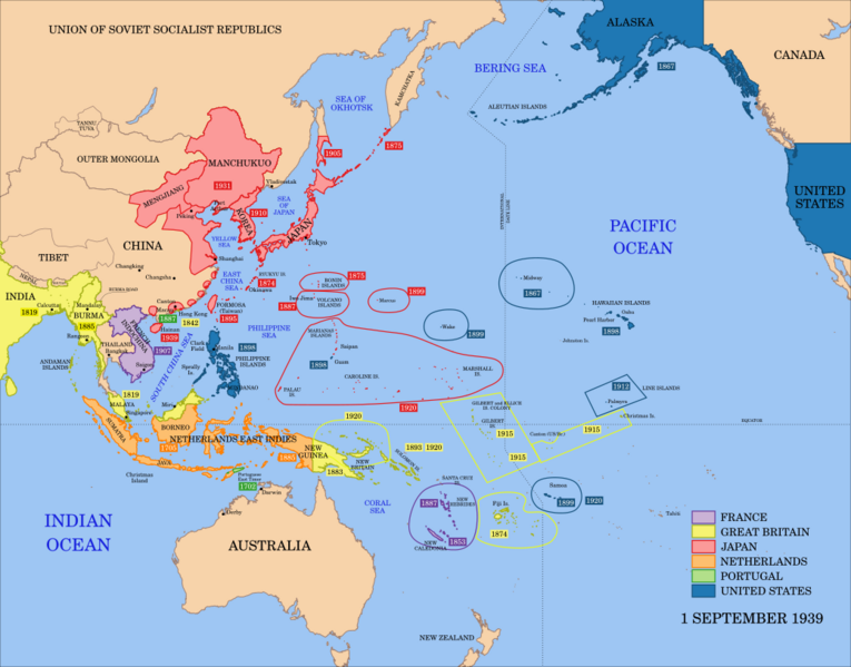
Descripción: A map of the Imperial Powers of the Pacific, 1939-09-01. Dates shown indicate the approximate year that the various powers gain control of their possessions. Japanese control of territory in China was tenuous.
Título: Pacific Area - The Imperial Powers 1939 - Map
Créditos: The borders for this map are primarily based on World2Hires_filled_mercator.svg and Image:Pacific_Area_-_The_Imperial_Powers_1939_-_Map.jpg, but some changes have been made based off information from other sources. Please edit the file if you have access to better information. The border of Manchukuo are based off Manchuria.jpg. The border of Portuguese East Timor is based off LocationEastTimor.svg. The border of Mengjiang is based off BlankMap-World 1939.png and The_location_of_Mengjiang_(as_done_in_glorious_mspaint).PNG. The borders of Tibet, China and Singkiang are based off the National Geographic "China Map 1945" and China_old_map_1936.jpg.
Autor(a): derivative work: Emok (talk) World2Hires_filled_mercator.svg: Emok Image:Pacific_Area_-_The_Imperial_Powers_1939_-_Map.jpg
Términos de Uso: Creative Commons Attribution-Share Alike 3.0
Licencia: CC BY-SA 3.0
Enlace de Licencia: https://creativecommons.org/licenses/by-sa/3.0
¿Se exige la atribución?: Sí
Usos del archivo
La siguiente página enlaza a este archivo:
