
Archivo: Ngorongoro topo
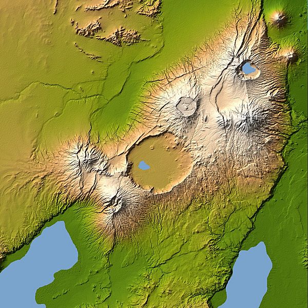
Descripción: Ngorongoro’s caldera is 22.5 kilometers (14 miles) across at its widest point and is 610 meters (2,000 feet) deep. Its floor is very level, holding a lake fed by streams running down the caldera wall. It is part of the Ngorongoro Conservation Area and is home to over 75,000 animals. The lakes south of the crater are Lake Eyasi and Lake Manyara, also part of the conservation area. Orientation: North toward the top, Mercator projection Image Data: shaded and colored SRTM elevation model. The shade image was derived by computing topographic slope in the northwest-southeast direction, so that northwest slopes appear bright and southeast slopes appear dark. Color coding is directly related to topographic height, with green at the lower elevations, rising through yellow and tan, to white at the highest elevations. Date Acquired: February 2000
Título: Ngorongoro topo
Créditos: NASA Earth Observatory, Topography of Olduvai Gorge, East Africa (Outcut)
Autor(a): NASA
Términos de Uso: Dominio Público
Licencia: Dominio Público
¿Se exige la atribución?: No
Usos del archivo
La siguiente página enlaza a este archivo:
