
Archivo: New York Harbor Waterfront 1727 panorama map
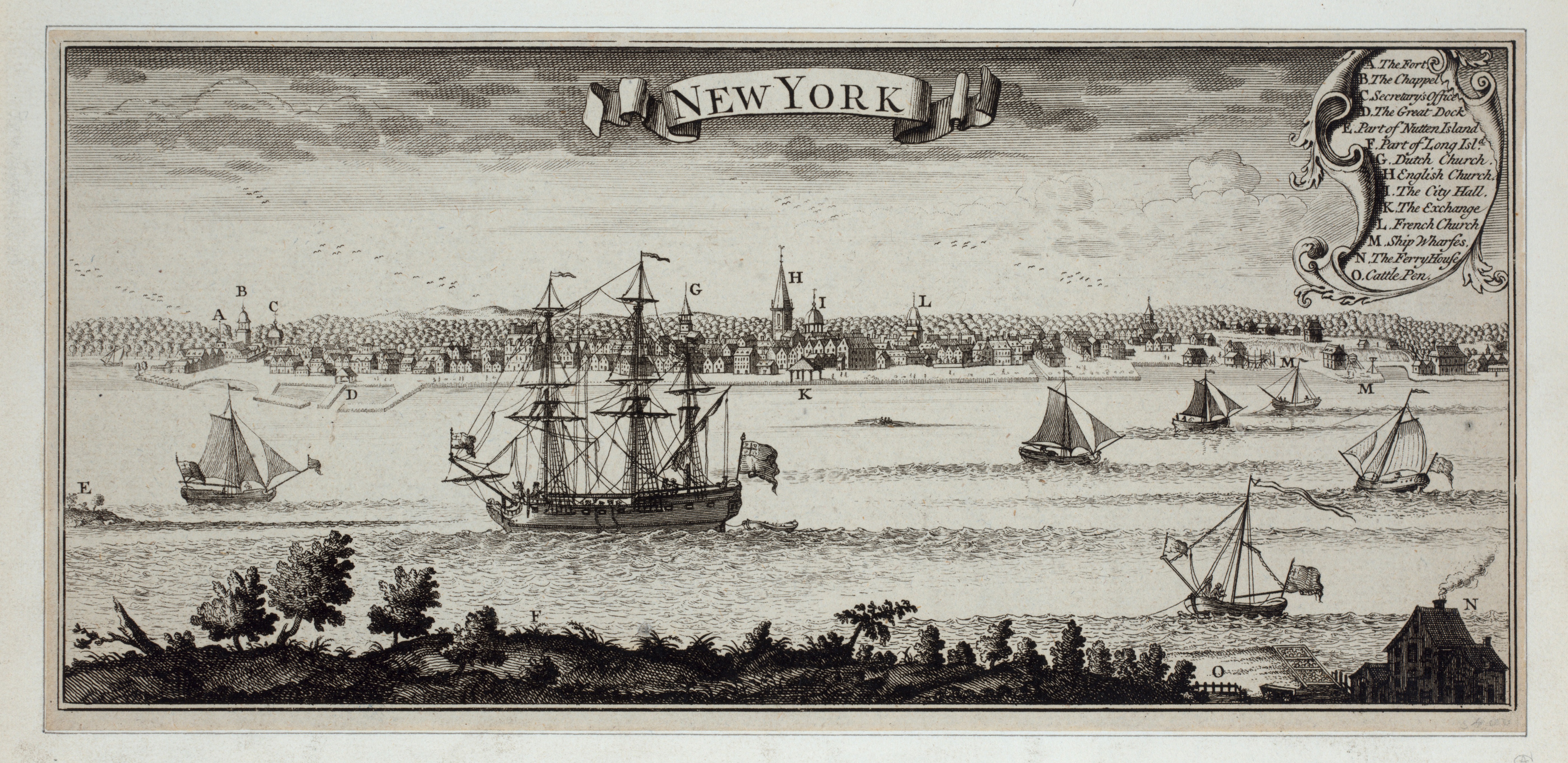
Descripción: A panoramic view of the New York Harbor waterfront seen from Long Island in 1727. This is an inset from A Map of the British Empire in America with the French and Spanish Settlements adjacent thereto, by Henry Popple. It was originally engraved by Willm. Henry Toms (who also signed it) & R.W. Seale, issued in 1733.[1] Image Title: New York A. The Fort; B. The Chappel; C. Secretary Office; D. The Great Dock; E. Part of Nutten Island; F. Part of Long Island; G. Dutch Church; H. English Church; I. The City Hall; K. The Exchange; L. French Church; M. Ship Warfes; N. The Ferry House; O. Cattle Pen
Título: New York Harbor Waterfront 1727 panorama map
Créditos: This image is available from the New York Public Library's Digital Library under the digital ID em13183: digitalgallery.nypl.org → digitalcollections.nypl.org
Autor(a): It was originally engraved by Willm. Henry Toms & R.W. Seale, issued in 1733. The view date is 1727.
Términos de Uso: Dominio Público
Licencia: Dominio Público
¿Se exige la atribución?: No
Usos del archivo
Las siguientes páginas enlazan a este archivo:
