
Archivo: Nevado del Ruiz hazard map, from Wright and Pierson
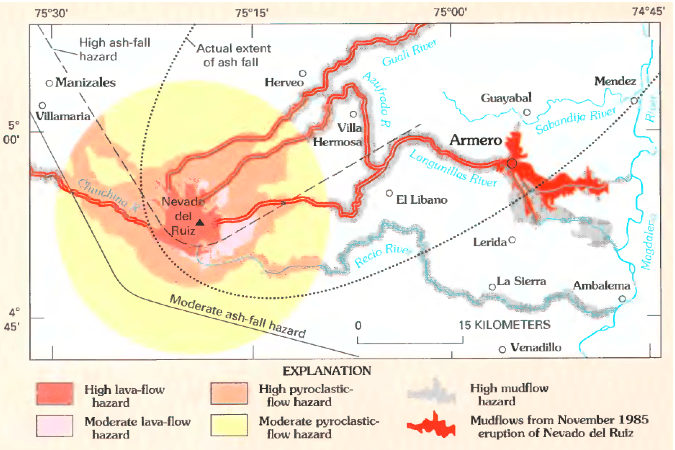
Description: Volcanic hazard map for Nevado del Ruiz. Lahars from 1985 eruption (which killed around 23,000 people) shown in red. Original caption: "Map showing hazards expected from an eruption of Nevado del Ruiz, Colombia. Such a map was prepared by INGEOMINAS (Colombian Institute of Geology and Mines) and circulated 1 month prior to the November 13, 1985, eruption of Nevado del Ruiz. Map shows danger from mudflows in the valley occupied by the town of Armero, Colombia, as well as areas affected by the hazards that resulted from this eruption. Circle denotes 20-kilometer limit."
Title: Nevado del Ruiz hazard map, from Wright and Pierson
Credit: Page 21 in Wright, Thomas L. and Pierson, Thomas C. (1992). Living with volcanoes (DJVU format), USGS Circular 1073. Bibliographic information and link to DJVU reader are online here.
Author: Wright, Thomas L. and Pierson, Thomas C.
Usage Terms: Public domain
License: Public domain
Attribution Required?: No
Usos del archivo
La siguiente página enlaza a este archivo:
