
Archivo: Nanyue map

Tamaño de esta previsualización: 667 × 600 píxeles. Otras resoluciones: 267 × 240 píxeles | 791 × 711 píxeles.
Archivo original (791 × 711 píxeles; tamaño de archivo: 895 KB; tipo MIME: image/png)
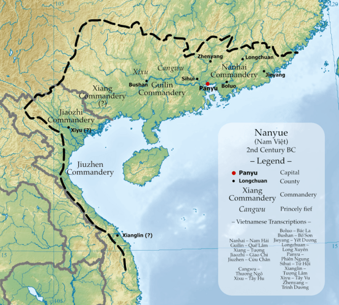
Description: Map of Nanyue Kingdom at its greatest territorial extent, with commanderies and known counties shown. Place names, locations and borders in this file are based on The Historical Atlas of China (中国历史地图集) by Tan Qixiang, and Administrative Geography during Western Han Dynasty (西汉政区地理) by Zhou Zhenhe. Base map is East Asia topographic map.png.
Title: Nanyue map
Credit: Own work
Author: Esiymbro
Usage Terms: Creative Commons Attribution-Share Alike 4.0
License: CC BY-SA 4.0
License Link: https://creativecommons.org/licenses/by-sa/4.0
Attribution Required?: Yes
Usos del archivo
La siguiente página enlaza a este archivo:

Todo el contenido de los artículos de la Enciclopedia Kiddle (incluidas las imágenes) se puede utilizar libremente para fines personales y educativos bajo la licencia Atribución-CompartirIgual a menos que se indique lo contrario.