
Archivo: McKittrick Tar Seep North of Highway 58
Tamaño de esta previsualización: 800 × 437 píxeles. Otras resoluciones: 320 × 175 píxeles | 1376 × 752 píxeles.
Archivo original (1376 × 752 píxeles; tamaño de archivo: 246 KB; tipo MIME: image/jpeg)
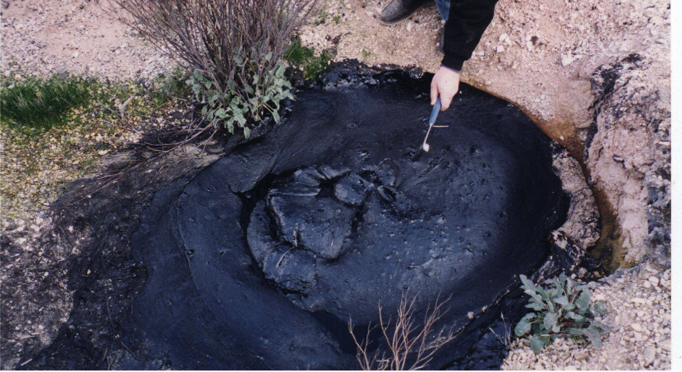
Description: This is one of the better looking natural tar seeps at the McKittrick Oil Field, in California. Sometimes the surface is hard, but in hot weather, it is soft. People like to light the gas bubbles that come out of the seep. The seeps are visible on Google maps as dark areas south of the intersection of Highway 33 and Highway 58, in the western San Joaquin Valley.
Title: McKittrick Tar Seep North of Highway 58
Credit: Own work
Author: Lldenke
Usage Terms: Creative Commons Attribution 3.0
License: CC BY 3.0
License Link: https://creativecommons.org/licenses/by/3.0
Attribution Required?: Yes
Usos del archivo
La siguiente página enlaza a este archivo:

Todo el contenido de los artículos de la Enciclopedia Kiddle (incluidas las imágenes) se puede utilizar libremente para fines personales y educativos bajo la licencia Atribución-CompartirIgual a menos que se indique lo contrario.