
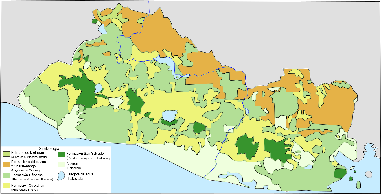
Archivo: Mapa geológico simplificado de El Salvador
Descripción: Simplified geological map of the Republic of El Salvador, which shows the stratigraphic units that broadly encompass the different geological characteristics of the country. These units are: The Metapán Strata (primarily Jurassic to Lower Miocene; which includes the Espinal Comple, Todos Santos formation, Grupo Yojoa, and Grupo Valle de los Angeles), The Morazán Formation Chalatenango Formation (these two are primarily from Oligocene to Miocene; and they are shown in the same color on the map), Bálsamo Formation (from late Miocene to Pliocene) Cuscatlán Formation (Lower Pleistocene; which the map shows the definition given by Reynolds JH (1980 and 1987), and shared by Lexa et al 2011, which defines it as: a set of products of predominantly silicic explosive volcanic activity associated with the evolution of Calderas, younger or contemporary to the Bálsamo Formation) Formation San Salvador (Upper Pleistocene) Aluvión (Holocene)
Autor: Juan Miguel
Términos de Uso: Atribución-CompartirIgual 3.0 No portada
Licencia: CC-BY-SA-3.0
Enlace de Licencia: http://creativecommons.org/licenses/by-sa/3.0/deed.es
¿Se exige la atribución?: Sí
Usos del archivo
La siguiente página enlaza a este archivo:
