
Archivo: Map of the shelling of Yeonpyeong

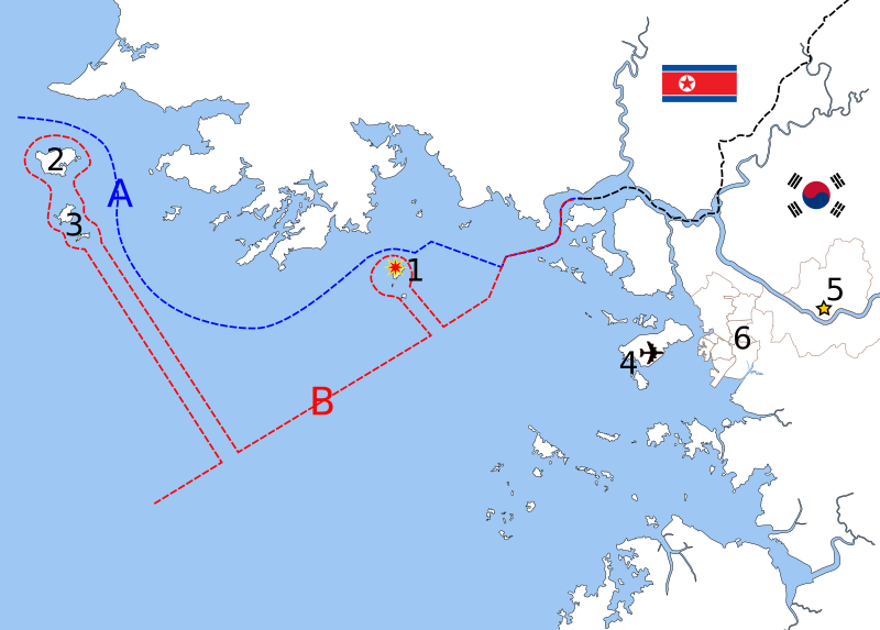
Descripción: Map of the shelling of Yeonpyeong, language neutral version. Yeonpyeong Island Baengnyeong Island Daecheong Myeon Jung-gu (Incheon Intl. Airport) Seoul IncheonA. Northern Limit Line (NLL, the border claimed by South Korea since 1953) B. Military Demarcation Line (the border claimed by North Korea since 1999)
Título: Map of the shelling of Yeonpyeong
Créditos: Based on File:Inchon islands 2.svg (by Amble) and File:朝韩争议区(延坪岛附近).svg (by 玖巧仔). Modified and converted to language neutral version by Tomchen1989. Flags are from File:Flag of South Korea.svg and File:Flag of North Korea.svg which are in the public domain. The Northern Limit Line and the Military Demarcation Line are according to Xinhua and NYTimes.
Autor(a): See above
Términos de Uso: Creative Commons Attribution-Share Alike 3.0
Licencia: CC BY-SA 3.0
Enlace de Licencia: https://creativecommons.org/licenses/by-sa/3.0
¿Se exige la atribución?: Sí
Usos del archivo
La siguiente página enlaza a este archivo:
