
Archivo: Map of the War of the Pacific.es

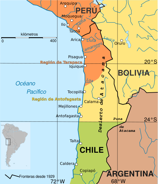
Descripción: Boundary before war (colored areas) and after the War of the Pacific (1879-1883) (black and red lines) Peruvian territories before the war Bolivian territories before the war Chilean territories before the war Peru-Bolivia Boundary in Atacama Desert according to File:Departamento moquegua 1865.JPG Argentina-Bolivia Boundary in Puna de Atacama and Tarija was contested according to File:MPazSoldan.1888-2xChile.djvu
Título: Map of the War of the Pacific.es
Créditos: Esta imagen ha sido extraída del archivo
Autor(a): Createaccount
Términos de Uso: Creative Commons Attribution-Share Alike 3.0
Licencia: CC BY-SA 3.0
Enlace de Licencia: https://creativecommons.org/licenses/by-sa/3.0
¿Se exige la atribución?: Sí
Usos del archivo
Las siguientes páginas enlazan a este archivo:
