
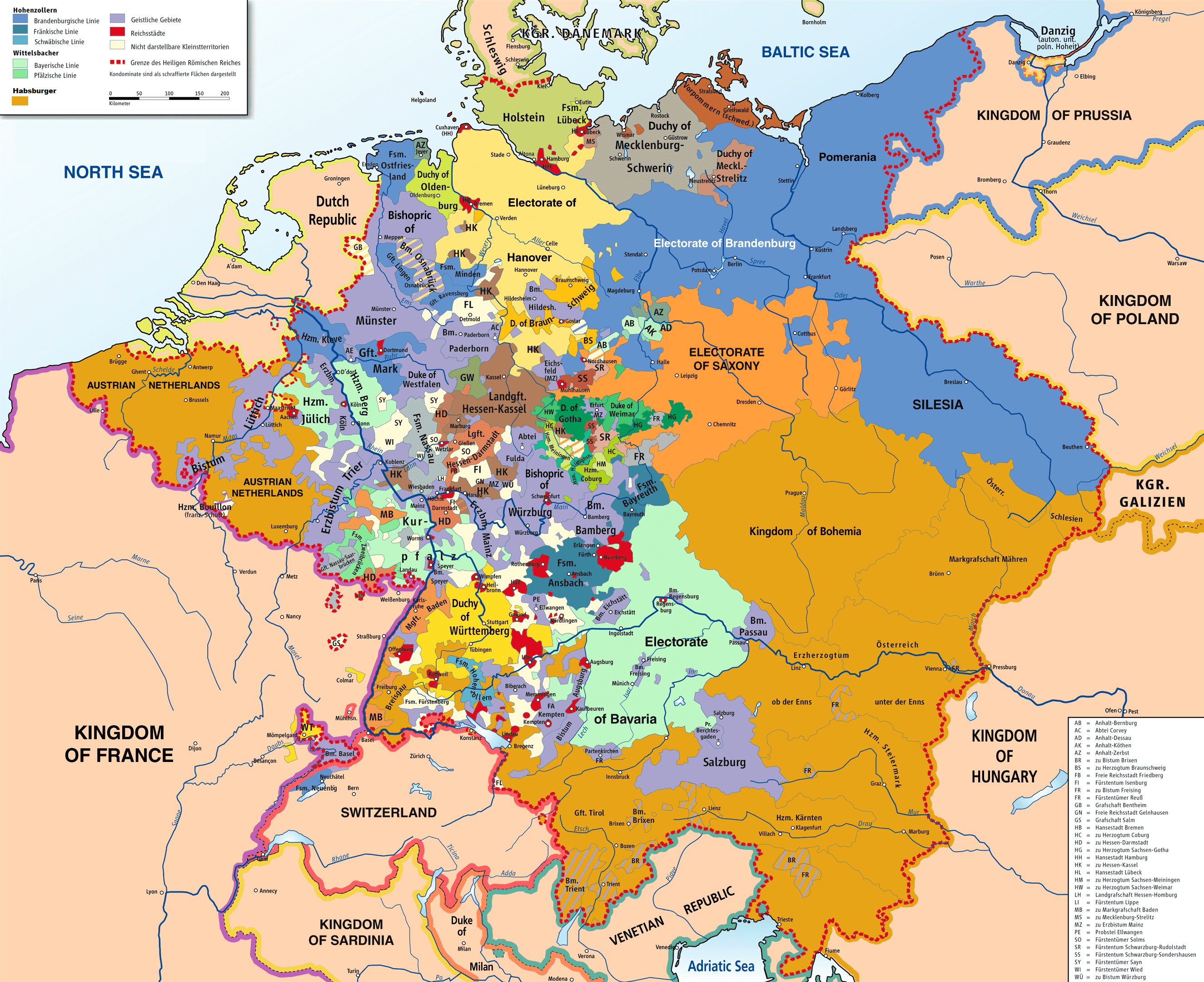
Archivo: Map of the Holy Roman Empire, 1789 en
Descripción: Map of the Holy Roman Empire, 1789, translated (somewhat) from original German version on Wikipedia Commons
Título: Map of the Holy Roman Empire, 1789 en
Créditos: Source of Information: Putzger – Historischer Weltatlas, 89. Auflage, 1965; Westermanns Großer Atlas zur Weltgeschichte, 1969; Haacks geographischer Atlas. VEB Hermann Haack Geographisch-Kartographische Anstalt, Gotha/Leipzig, 1. Auflage, 1979; dtv-Atlas zur Weltgeschichte Band 1: Von den Anfängen bis zur Französischen Revolution; 23. Aufl. 1989, ISBN 3-423-03002-X
Autor(a): Robert Alfers, kgberger
Términos del Uso: Creative Commons Attribution-Share Alike 3.0
Licencia: CC BY-SA 3.0
Enlace de Licencia: https://creativecommons.org/licenses/by-sa/3.0
¿Se exige la atribución?: Sí
Usos del archivo
La siguiente página enlaza a este archivo:
