
Archivo: Map of the Battle of Jutland, 1916-es

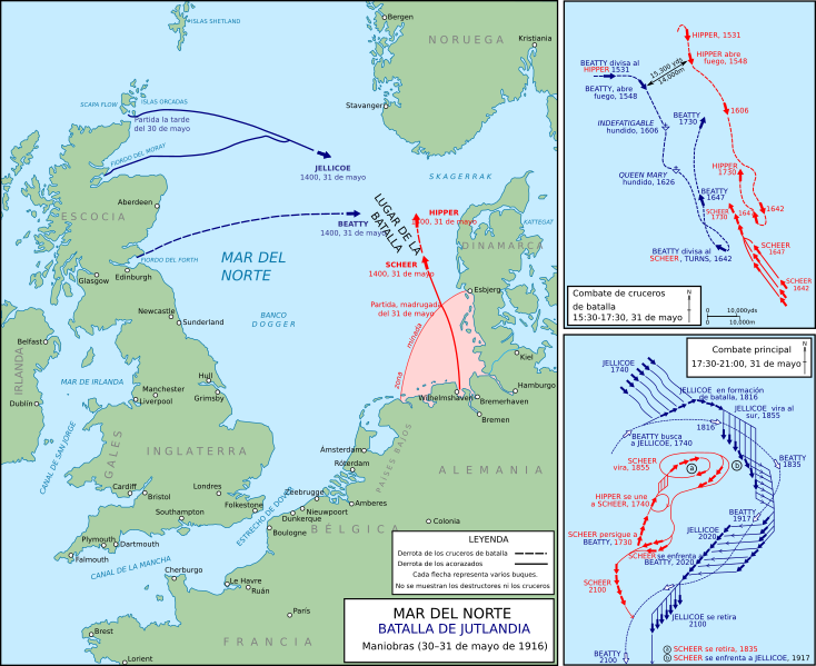
Descripción: A map of the Battle of Jutland. Adapted from File:Jutland1916.jpg, a work of the Department of History at the United States Military Academy, which is in the public domain. Additional details taken from Sondhaus, Lawrence Navies in Modern World History, pp. 191–192 Times are given in military format, i.e. 1917 refers to 19:17, being 7:17 PM. Wilhelmshaven location taken from OpenStreetMap (link). Cologne location taken from OpenStreetMap (link). Kristiania (now known as Oslo) location taken from OpenStreetMap (link).
Título: Map of the Battle of Jutland, 1916-es
Créditos: Esta imagen ha sido extraída del archivo
Autor(a): Grandiose (discusión), rowanwindwhistler (discusión)
Términos de Uso: Creative Commons Attribution-Share Alike 4.0
Licencia: CC BY-SA 4.0
Enlace de Licencia: https://creativecommons.org/licenses/by-sa/4.0
¿Se exige la atribución?: Sí
Usos del archivo
La siguiente página enlaza a este archivo:
