
Archivo: Map of the Arctic, 1780s - B&W
Tamaño de esta previsualización: 698 × 600 píxeles. Otras resoluciones: 279 × 240 píxeles | 10 928 × 9392 píxeles.
Archivo original (10 928 × 9392 píxeles; tamaño de archivo: 16,09 MB; tipo MIME: image/jpeg)
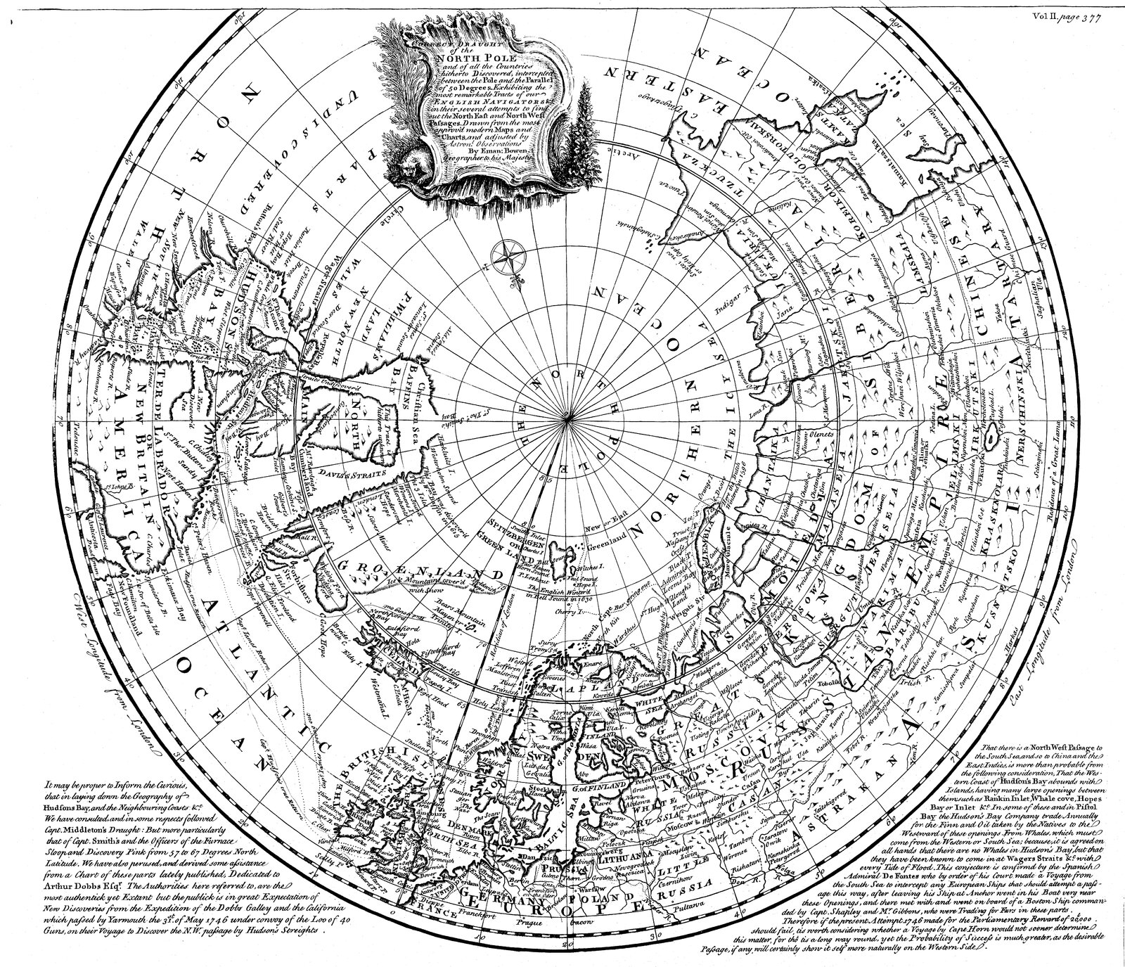
Description: A map of the Arctic ocean and the surrounding continents, titled "A correct draught of the North Pole and of all the countries hitherto discovered, intercepted between the Pole and the parallel of 50 degrees"
Title: Map of the Arctic, 1780s - B&W
Credit: Memorial University Digital Archives Institute
Author: Emanuel Bowen
Usage Terms: Public domain
License: Public domain
Attribution Required?: No
Usos del archivo
La siguiente página enlaza a este archivo:

Todo el contenido de los artículos de la Enciclopedia Kiddle (incluidas las imágenes) se puede utilizar libremente para fines personales y educativos bajo la licencia Atribución-CompartirIgual a menos que se indique lo contrario.