
Archivo: Map of Blackford County, Indiana

Tamaño de esta previsualización PNG del archivo SVG: 600 × 600 píxeles. Otra resolución: 240 × 240 píxeles.
Archivo original (archivo SVG, nominalmente 768 × 768 píxeles, tamaño de archivo: 508 KB)
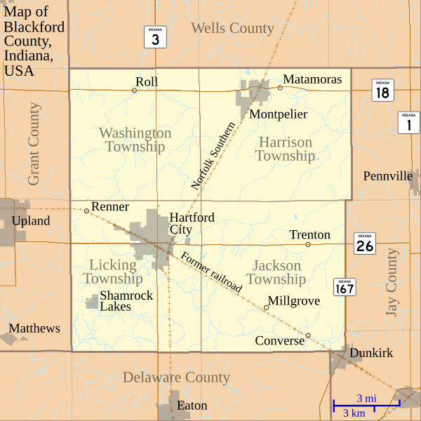
Description: This is a map of Blackford County, Indiana, USA which shows settlements, county and township borders, and major transportation routes.
Title: Map of Blackford County, Indiana
Credit: My own work, using custom-written MapScript applications with freely-available United States Census Bureau TIGER data
Author: Omnedon
Usage Terms: Public domain
License: Public domain
Attribution Required?: No
Usos del archivo
Las siguientes páginas enlazan a este archivo:

Todo el contenido de los artículos de la Enciclopedia Kiddle (incluidas las imágenes) se puede utilizar libremente para fines personales y educativos bajo la licencia Atribución-CompartirIgual a menos que se indique lo contrario.