
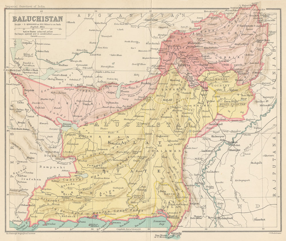
Archivo: Map of Baluchistan from The Imperial Gazetteer of India (1907-1909)
Tamaño de esta previsualización: 710 × 599 píxeles. Otras resoluciones: 284 × 240 píxeles | 1000 × 844 píxeles.
Archivo original (1000 × 844 píxeles; tamaño de archivo: 254 KB; tipo MIME: image/jpeg)
Description: Map of Baluchistan from The Imperial Gazetteer of India Volume 6, opposite page 336.. New edition, published under the authority of His Majesty's Secretary of State for India in Council. Oxford: Clarendon Press, 1907-1909. Scale: 1:6,000,000. 1 in. to 94.6 miles. Native States colored yellow.
Title: Map of Baluchistan from The Imperial Gazetteer of India (1907-1909)
Credit: http://dsal.uchicago.edu/maps/gazetteer/index.html
Author: John G. Bartholomew
Usage Terms: Public domain
License: Public domain
Attribution Required?: No
Usos del archivo
Las siguientes páginas enlazan a este archivo:
.jpg&oldid=1266395)

Todo el contenido de los artículos de la Enciclopedia Kiddle (incluidas las imágenes) se puede utilizar libremente para fines personales y educativos bajo la licencia Atribución-CompartirIgual a menos que se indique lo contrario.
.jpg)