
Archivo: Map-GermanConfederation

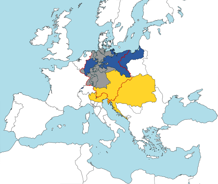
Description: The German Confederation (Deutscher Bund) - map from 1820
Title: Map-GermanConfederation
Credit: Based on map data of the IEG-Maps project (Andreas Kunz, B. Johnen and Joachim Robert Moeschl: University of Mainz) - http://www.ieg-maps.uni-mainz.de ; this source shows Finland, Poland, Tunisia & Serbia as independent states but Wallachia & Moldavia, also vassal principalities (as the deylik of Tunis & the principality of Serbia) are missing : see the « Westermann Grosser Atlas zur Weltgeschichte », 1985, ISBN 3-14-100919-8 & the « Putzger historischer Weltatlas Cornelsen » 1990, ISBN 3-464-00176-8.
Author: User:52 Pickup
Usage Terms: Creative Commons Attribution-Share Alike 3.0
License: CC-BY-SA-3.0
License Link: http://creativecommons.org/licenses/by-sa/3.0/
Attribution Required?: Yes
Usos del archivo
Las siguientes páginas enlazan a este archivo:
