
Archivo: Mangrove Mapping

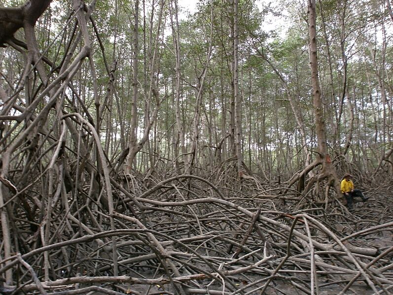
Descripción: A researcher takes a break from fieldwork amongst the dense mangrove forests of Guayaquil, Ecuador. Mangroves are tropical riparian vegetation that provide important ecosystem services such as carbon storage, habitats for a wide variety of fauna and support to local populations. Despite this, mangrove forests are threatened across their range due to anthropogenic degradation. In order to protect these fragile ecosystems remote sensing data is being used to map and monitor their extents. An important part of this research is conducting fieldwork to validate the results from the remotely sensed data. Collecting data such as tree diameter and height is difficult in conditions like these where the mangrove roots create a dense maze, anchored in thick underlying mud. The roots are regularly taller than 2m and are as strong as steel despite their weak and spindly appearance. In combination with tropical temperatures and humidity and an encroaching tide, transit around these forests is challenging and slow work. This photograph was taken using an olympus signal camera during fieldwork that was in support of my PhD.
Título: Mangrove Mapping
Créditos: Trabajo propio
Autor(a): NathanMThomas
Términos de Uso: Creative Commons Attribution-Share Alike 4.0
Licencia: CC BY-SA 4.0
Enlace de Licencia: https://creativecommons.org/licenses/by-sa/4.0
¿Se exige la atribución?: Sí
Usos del archivo
La siguiente página enlaza a este archivo:
