
Archivo: MODIS Map
Tamaño de esta previsualización: 800 × 400 píxeles. Otras resoluciones: 320 × 160 píxeles | 5400 × 2700 píxeles.
Archivo original (5400 × 2700 píxeles; tamaño de archivo: 11,84 MB; tipo MIME: image/jpeg)
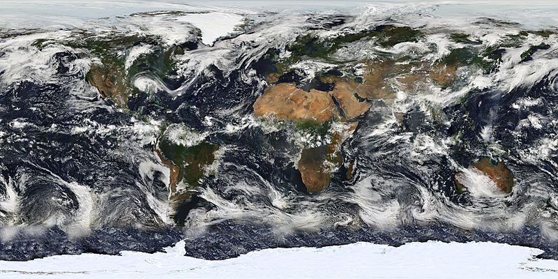
Description: This image is based largely on observations from the Moderate Resolution Imaging Spectroradiometer (MODIS) - a sensor aboard the Terra satellite - on July 11, 2005. Small gaps in MODIS' coverage between overpasses, as well as Antarctica (which is in polar darkness in July), have been filled in using GOES weather satellites and the latest version of the NASA Blue Marble. Hurricane Dennis can be seen moving inland over the Gulf Coast.
Title: MODIS Map
Credit: Earth's Vital Signs
Author: NASA
Usage Terms: Public domain
License: Public domain
Attribution Required?: No
Usos del archivo

Todo el contenido de los artículos de la Enciclopedia Kiddle (incluidas las imágenes) se puede utilizar libremente para fines personales y educativos bajo la licencia Atribución-CompartirIgual a menos que se indique lo contrario.