
Archivo: Livingston-Island-Map-2010-15
Tamaño de esta previsualización: 799 × 600 píxeles. Otras resoluciones: 320 × 240 píxeles | 5337 × 4006 píxeles.
Archivo original (5337 × 4006 píxeles; tamaño de archivo: 10,92 MB; tipo MIME: image/png)
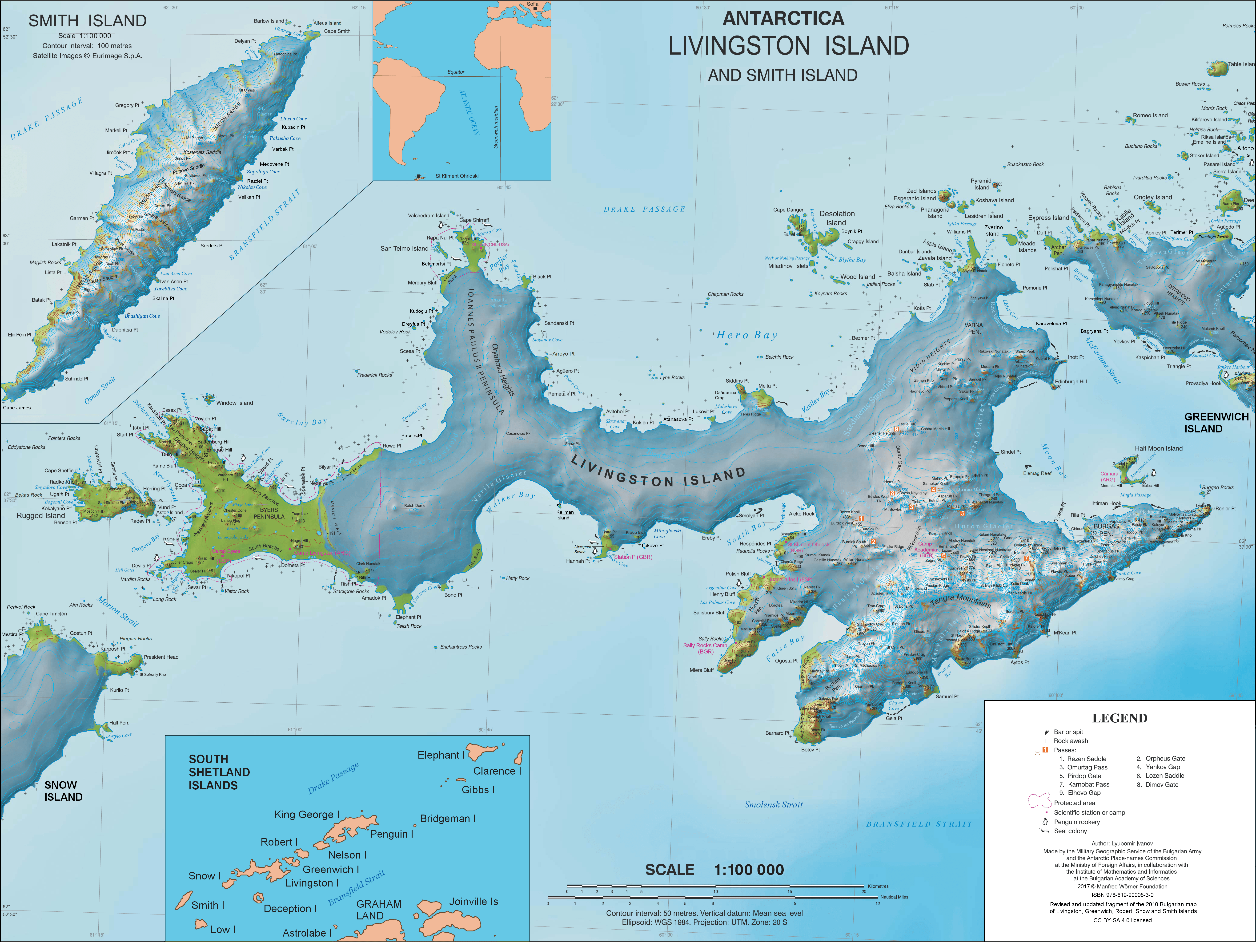
Description: L.L. Ivanov. Antarctica: Livingston Island and Smith Island. Scale 1:100000 topographic map. Manfred Wörner Foundation, 2017. ISBN 978-619-90008-3-0
Title: Livingston-Island-Map-2010-15
Credit: Own work
Author: Apcbg
Permission: Published by the Manfred Wörner Foundation under the Creative Commons Attribution ShareAlike 4.0 license.
Usage Terms: Creative Commons Attribution-Share Alike 4.0
License: CC BY-SA 4.0
License Link: http://creativecommons.org/licenses/by-sa/4.0
Attribution Required?: Yes
Usos del archivo
Las siguientes páginas enlazan a este archivo:

Todo el contenido de los artículos de la Enciclopedia Kiddle (incluidas las imágenes) se puede utilizar libremente para fines personales y educativos bajo la licencia Atribución-CompartirIgual a menos que se indique lo contrario.