
Archivo: Lituya Bay overview
No disponible en mayor resolución.
Lituya_Bay_overview.jpg (750 × 580 píxeles; tamaño de archivo: 111 KB; tipo MIME: image/jpeg)
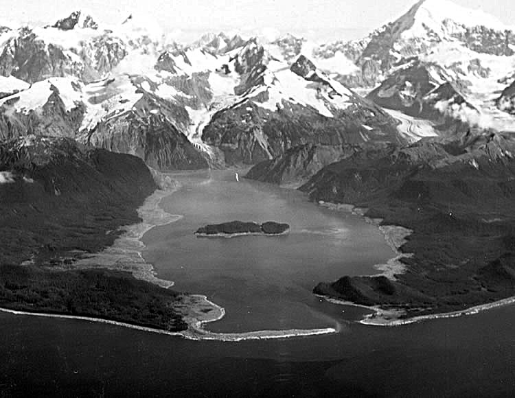
Description: Lituya Bay a few weeks after the 1958 tsunami. The areas of destroyed forest along the shorelines are clearly recognizable as the light areas rimming the bay. A fishing boat anchored in the cove at lower left was carried over the spit in the foreground; a boat under way near the entrance was sunk; and a third boat, anchored near the lower right, rode out the wave. Photo by D.J. Miller, United States Geological Survey.
Title: Lituya Bay overview
Credit: USGS via [1]
Author: D.J. Miller, United States Geological Survey
Usage Terms: Public domain
License: Public domain
Attribution Required?: No
Usos del archivo
Las siguientes páginas enlazan a este archivo:

Todo el contenido de los artículos de la Enciclopedia Kiddle (incluidas las imágenes) se puede utilizar libremente para fines personales y educativos bajo la licencia Atribución-CompartirIgual a menos que se indique lo contrario.