
Archivo: LesserSundaIslands A2003077 0210 250m
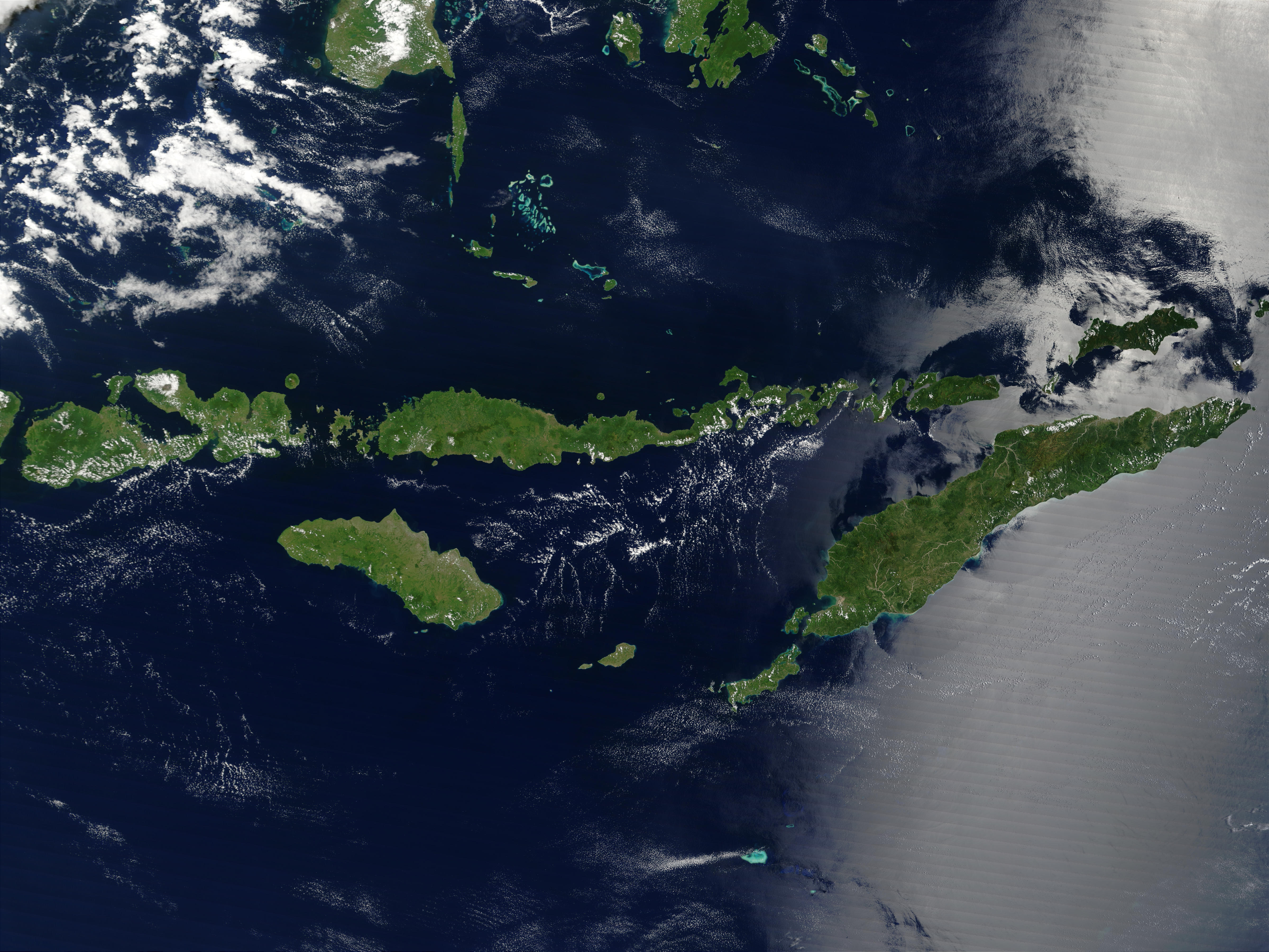
Descripción: Indonesia´s Lesser Sunda Islands sparkle like green gems against the sapphire-blue waters of the Indian Ocean and Flores, Banda, Sawu, and Timor Seas. These islands form the southern border of Indonesia with Australia and stretch for 1,200 kilometers from the western island of Lombok on the left to the eastern tip of Timor, the largest island in the image. In a few places, bright turquoise-blue spots on the water mark tiny islands surrounded by shallow waters: the Kepulauan Taka´Bonerate islands in the upper center of the image, the Kepulauan Tukangbesi islands in the upper right, and the Ashmore and Cartier Islands (Australian territories) in the lower center. MODIS also detected a fire in this scene on Buton Island in the upper center part of this scene; the fire is marked in red. This true-color Terra MODIS image was acquired on March 18, 2003. Credit Jeff Schmaltz, MODIS Rapid Response Team, NASA/GSFC Sensor Terra/MODIS To view more images from NASA's Visible Earth go to: visibleearth.nasa.gov/ NASA Goddard Space Flight Center is home to the nation's largest organization of combined scientists, engineers and technologists that build spacecraft, instruments and new technology to study the Earth, the sun, our solar system, and the universe.
Título: LesserSundaIslands A2003077 0210 250m
Créditos: http://visibleearth.nasa.gov/view_rec.php?id=5137
Autor(a): NASA
Términos de Uso: Dominio Público
Licencia: Dominio Público
¿Se exige la atribución?: No
Usos del archivo
La siguiente página enlaza a este archivo:
