
Archivo: Lakebalkhashbasinmap

Tamaño de esta previsualización: 800 × 546 píxeles. Otras resoluciones: 320 × 218 píxeles | 1466 × 1000 píxeles.
Archivo original (1466 × 1000 píxeles; tamaño de archivo: 1,52 MB; tipo MIME: image/png)
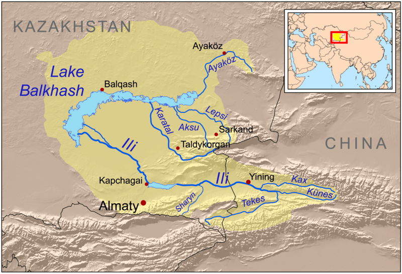
Description: This is a map of the Lake Balkhash drainage basin, including the Ili River and its tributaries.
Title: Lakebalkhashbasinmap
Credit: Own work using Digital Chart of the World and GTOPO data, labels based on GEOnet. UNEP and Decrease of river runoff in the Lake Balkhash basin in Central Asia by Kader Kezer and Hiroshi Matsuyama used as references.
Author: Kmusser
Usage Terms: Creative Commons Attribution-Share Alike 3.0
License: CC BY-SA 3.0
License Link: http://creativecommons.org/licenses/by-sa/3.0
Attribution Required?: Yes
Usos del archivo
La siguiente página enlaza a este archivo:

Todo el contenido de los artículos de la Enciclopedia Kiddle (incluidas las imágenes) se puede utilizar libremente para fines personales y educativos bajo la licencia Atribución-CompartirIgual a menos que se indique lo contrario.