
Archivo: Lake eyre basin map

Tamaño de esta previsualización: 600 × 600 píxeles. Otras resoluciones: 240 × 240 píxeles | 990 × 990 píxeles.
Archivo original (990 × 990 píxeles; tamaño de archivo: 292 KB; tipo MIME: image/png)
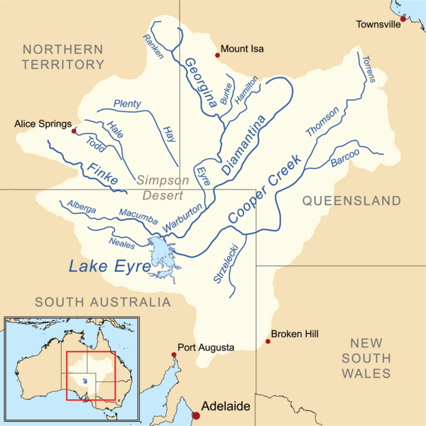
Description: This is a map of the Lake Eyre drainage basin including the major rivers. Note that the river courses shown are usually dry.
Title: Lake eyre basin map
Credit: Own work using Digital Chart of the World. The Rand McNally New International Atlas (1993) and this Department of the Environment, Water, Heritage and the Arts map used as references.
Author: Kmusser
Usage Terms: Creative Commons Attribution-Share Alike 3.0
License: CC BY-SA 3.0
License Link: http://creativecommons.org/licenses/by-sa/3.0
Attribution Required?: Yes
Usos del archivo
Las siguientes páginas enlazan a este archivo:

Todo el contenido de los artículos de la Enciclopedia Kiddle (incluidas las imágenes) se puede utilizar libremente para fines personales y educativos bajo la licencia Atribución-CompartirIgual a menos que se indique lo contrario.