
Archivo: La Plata River aerial
Tamaño de esta previsualización: 800 × 450 píxeles. Otras resoluciones: 320 × 180 píxeles | 2688 × 1512 píxeles.
Archivo original (2688 × 1512 píxeles; tamaño de archivo: 1,35 MB; tipo MIME: image/jpeg)
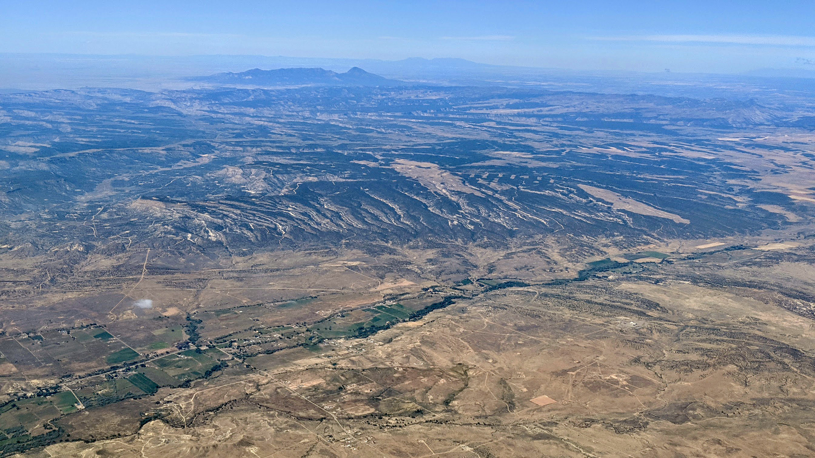
Description: Aerial view of the La Plata River (San Juan River tributary) crossing into New Mexico from Colorado, with the town of La Plata, New Mexico, at left foreground. Mesa Verde is in the right background; to the left beyond the Mesa is Navajo Wash. Further, at about 40 miles, just left of center, are Colorado's Black Mountain and Ute Peak. Even further, at about 100 miles, the Abajo Mountains, in Utah, are visible on the horizon.
Title: La Plata River aerial
Credit: Own work
Author: Dicklyon
Usage Terms: Creative Commons Attribution-Share Alike 4.0
License: CC BY-SA 4.0
License Link: https://creativecommons.org/licenses/by-sa/4.0
Attribution Required?: Yes
Usos del archivo
Las siguientes páginas enlazan a este archivo:

Todo el contenido de los artículos de la Enciclopedia Kiddle (incluidas las imágenes) se puede utilizar libremente para fines personales y educativos bajo la licencia Atribución-CompartirIgual a menos que se indique lo contrario.