
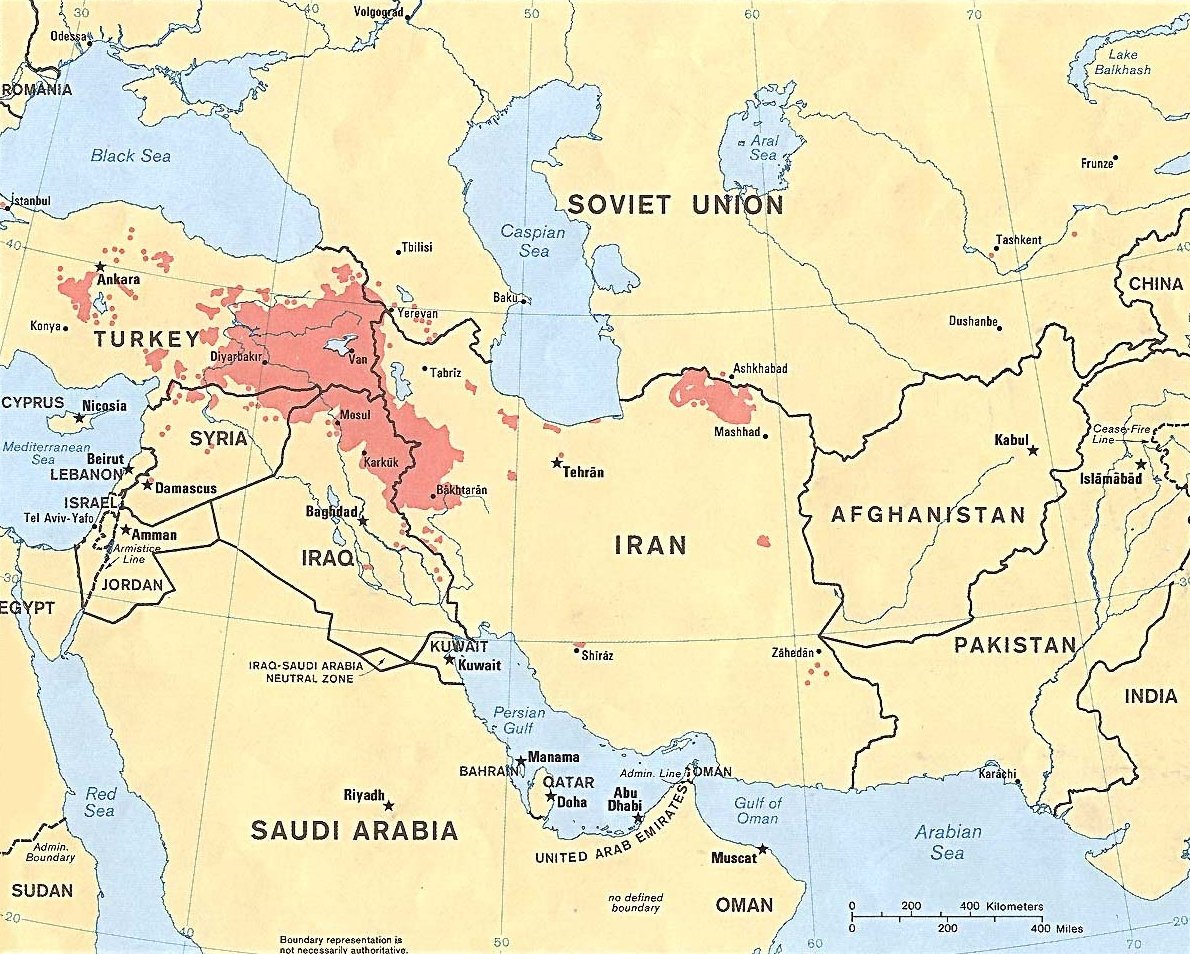
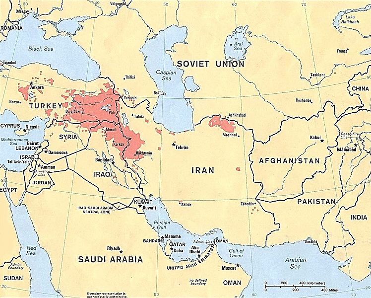
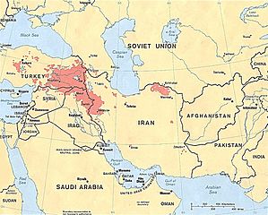
Archivo: Kurdish-inhabited areas of the Middle East and the Soviet Union in 1986
Tamaño de esta previsualización: 748 × 600 píxeles. Otras resoluciones: 299 × 240 píxeles | 1190 × 954 píxeles.
Archivo original (1190 × 954 píxeles; tamaño de archivo: 288 KB; tipo MIME: image/jpeg)
Description: Kurdish-inhabited areas of the Middle East and the Soviet Union in 1986
Title: Kurdish-inhabited areas of the Middle East and the Soviet Union in 1986
Credit: 800603 (544643) 3-86
Author: U.S. Central Intelligence Agency
Permission: See the list of maps at http://www.lib.utexas.edu/maps/iraq.html for a link to this map and related maps. That page says: "The following maps were produced by the U.S. Central Intelligence Agency, unless otherwise indicated." This particular map is labeled there as "Kurdish Areas in the Middle East and the Soviet Union. 1986."
Usage Terms: Public domain
License: Public domain
Attribution Required?: No
Usos del archivo
La siguiente página enlaza a este archivo:

Todo el contenido de los artículos de la Enciclopedia Kiddle (incluidas las imágenes) se puede utilizar libremente para fines personales y educativos bajo la licencia Atribución-CompartirIgual a menos que se indique lo contrario.