
Archivo: KavirNP Iran L7 aug00sep01
No disponible en mayor resolución.
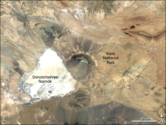
KavirNP_Iran_L7_aug00sep01.jpg (540 × 405 píxeles; tamaño de archivo: 110 KB; tipo MIME: image/jpeg)
Description: Landsat image of w:Kavir National Park in Iran. This image combines data from two different satellite overpasses of the area collected by the Enhanced Thematic Mapper Plus (ETM+) on the Landsat 7 satellite. The left half of the image was acquired on August 28, 2000, the right half on September 7, 2001.
Title: KavirNP Iran L7 aug00sep01
Credit: http://earthobservatory.nasa.gov/Newsroom/NewImages/images.php3?img_id=16993
Author: Jesse Allen, Earth Observatory, using data obtained from the University of Maryland’s Global Land Cover Facility.
Permission: Public domain
Usage Terms: Public domain
License: Public domain
Attribution Required?: No
Usos del archivo
La siguiente página enlaza a este archivo:

Todo el contenido de los artículos de la Enciclopedia Kiddle (incluidas las imágenes) se puede utilizar libremente para fines personales y educativos bajo la licencia Atribución-CompartirIgual a menos que se indique lo contrario.