
Archivo: John Norden's Map of Westminster - Charing Cross
No disponible en mayor resolución.
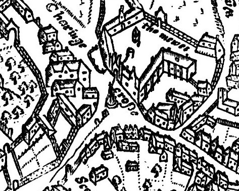
John_Norden's_Map_of_Westminster_-_Charing_Cross.jpg (473 × 378 píxeles; tamaño de archivo: 154 KB; tipo MIME: image/jpeg)
Description: John Norden's Map of Westminster, 1593, engraved by Pieter Van den Keere. Original size 9.5 x 6.75 inches, published in Norden's "Middlesex", dated 1593. Norden was born c. 1548, and was made Surveyor of His Majesty's Woods in 1609. Detail of Charing Cross and surrounding area. The map is oriented with north-west to the top: Whitehall is to the bottom left, and the Strand to the bottom right.
Title: John Norden's Map of Westminster - Charing Cross
Credit: File:John Norden's Map of Westminster Large version.jpeg
Author: John Norden, 1593
Usage Terms: Public domain
License: Public domain
Attribution Required?: No
Usos del archivo
La siguiente página enlaza a este archivo:

Todo el contenido de los artículos de la Enciclopedia Kiddle (incluidas las imágenes) se puede utilizar libremente para fines personales y educativos bajo la licencia Atribución-CompartirIgual a menos que se indique lo contrario.