
Archivo: John-Tallis-1851-Tibet-Mongolia-and-Manchuria-NE

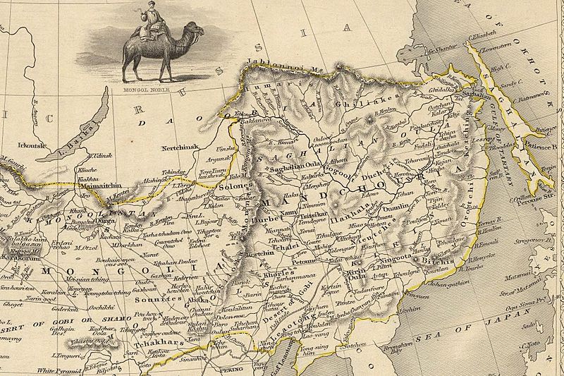
Description: The NE section (Manchuria and Mongolia) of the map of the northern and western part of the Chinese Empire - "Thibet, Mongolia, and Mandchouria". The borders are shows as per the 1858 treaty of Aigun. The main Russian center in Transbaikalia is still Nerchinsk, rather than Chita. The outline of Sakhalin is already shown fairly correctly, but the body of water separating it from the mainland is still labeled "Gulf of Tartary" (rather than '"Strait).
Title: John-Tallis-1851-Tibet-Mongolia-and-Manchuria-NE
Credit: John-Tallis-1851-Tibet-Mongolia-and-Manchuria-33621.jpg
Author: John-Tallis-1851-Tibet-Mongolia-and-Manchuria-33621.jpg: The staff of John Tallis: The Illustrations by H. Winkles & Engraved by G. Greatbach. The Map Drawn & Engraved by J. Rapkin. derivative work: Vmenkov (talk)
Usage Terms: Public domain
License: Public domain
Attribution Required?: No
Usos del archivo
Las siguientes páginas enlazan a este archivo:
