
Archivo: Iberian Peninsula antique map
Tamaño de esta previsualización: 739 × 599 píxeles. Otras resoluciones: 296 × 240 píxeles | 2096 × 1700 píxeles.
Archivo original (2096 × 1700 píxeles; tamaño de archivo: 5,81 MB; tipo MIME: image/jpeg)
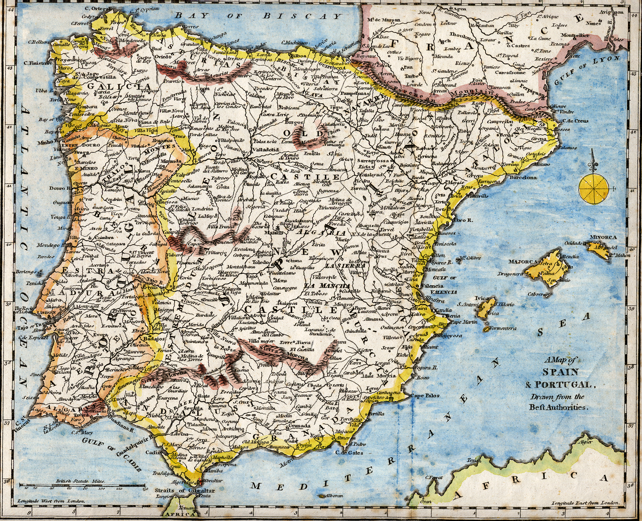
Description: 18th century hand-coloured engraved map of the Iberian peninsula depicting various topographical features of the land, as published in Robert Wilkinson's General Atlas, circa 1794. (Volume 2., page 666.) Titl'd A Map of Spain & Portugal, Drawn from the Beſt Authorities
Title: Iberian Peninsula antique map
Credit: Scanned from my personal collection. (scanned by User:RedCoat)
Author: Robert Wilkinson
Usage Terms: Public domain
License: Public domain
Attribution Required?: No
Usos del archivo
La siguiente página enlaza a este archivo:

Todo el contenido de los artículos de la Enciclopedia Kiddle (incluidas las imágenes) se puede utilizar libremente para fines personales y educativos bajo la licencia Atribución-CompartirIgual a menos que se indique lo contrario.