
Archivo: Guadeloupe Places of interest map-fr

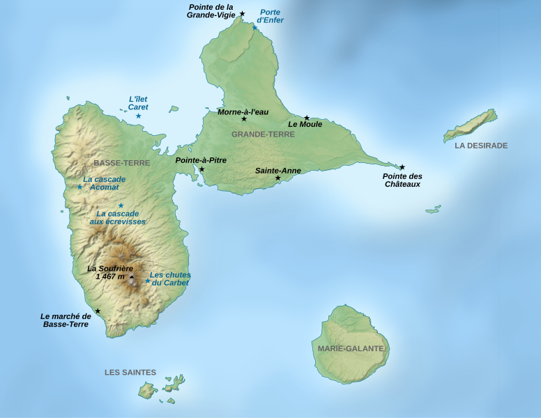
Descripción: Map of places of interest in Guadeloupe, a French overseas department in the Antilles.
Título: Guadeloupe Places of interest map-fr
Créditos: travail personnel (own work). Data sources: Background map : data from NASA Shuttle Radar Topography Mission (SRTM3 v.2 & SWDB) (public domain) Bathymetry : Demis (see the approval e-mail and the Demis forum).Softwares used: NASA datas edited with 3DEM and Global Mapper 9 (limited version) by the United States Geological Survey (USGS) Demis data edited with Demis Mapper Vectorized with Inkscape Cartographic tutorials (in french)Others: UTM map projection WGS84 geodetic system Shaded relief (ligth direction) : altitude 80°, azimuth 315° Font: Arial The background map is a raster image embedded in the SVG file.
Autor(a): Sémhur
Términos de Uso: Creative Commons Attribution-Share Alike 4.0
Licencia: CC BY-SA 4.0
Enlace de Licencia: https://creativecommons.org/licenses/by-sa/4.0
¿Se exige la atribución?: Sí
Usos del archivo
La siguiente página enlaza a este archivo:
