
Archivo: Great Slave Lake Sat
No disponible en mayor resolución.
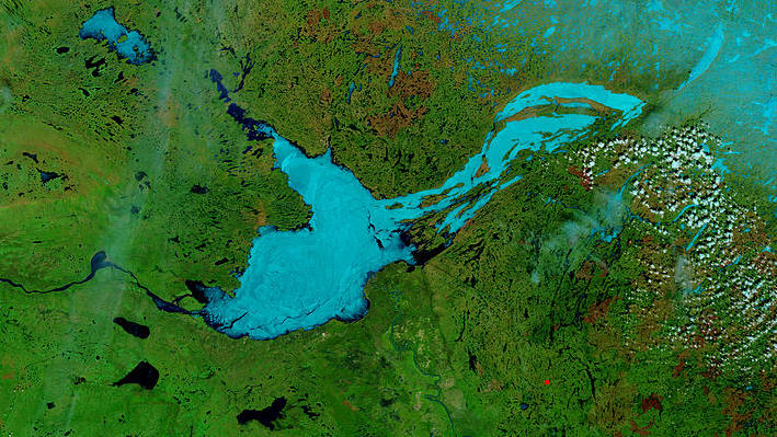
Great_Slave_Lake_Sat.jpg (709 × 399 píxeles; tamaño de archivo: 113 KB; tipo MIME: image/jpeg)
Description: These true- and false-color images of central Canada show the Great Slave Lake in the Northwest Territories (top) and Lake Athabasca to the southeast. Lake Athabasca straddles the border between Alberta (west) and Saskatchewan (east). A fire (red dot) is burning in Alberta, and the snow capped Rocky Mountains cut through southwest Alberta at bottom left. In the false-color image, vegetation is green, water is dark blue, and ice (or snow) is light blue. -NASA
Title: Great Slave Lake Sat
Credit: NASA Visible Earth
Author: NASA
Usage Terms: Public domain
License: Public domain
Attribution Required?: No
Usos del archivo
La siguiente página enlaza a este archivo:

Todo el contenido de los artículos de la Enciclopedia Kiddle (incluidas las imágenes) se puede utilizar libremente para fines personales y educativos bajo la licencia Atribución-CompartirIgual a menos que se indique lo contrario.