
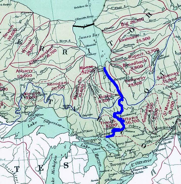
Archivo: GRAND Canal proposal (James Bay to Lake Huron)
Description: Possible scenario of the GRAND Canal scheme, showing the initial water capture and diversion into Lake Huron. Water would be pumped south from the newly-formed James Lake into the Harricana River, crossing into the the Great Lakes watershed near Amos, into Lake Timiskaming and the Ottawa River, crossing near Mattawa into Lake Nipissing and the French River to Lake Huron. Information overlaid on cropped Atlas of Canada's map Drainage Basins, ca. 1906.
Title: GRAND Canal proposal (James Bay to Lake Huron)
Credit: Information on GRAND Canal from the GRAND Canal homepage, background map from Atlas of Canada's map Drainage Basins, ca. 1906
Author: Natural Resources Canada & User:Super cyclist
Usage Terms: Public domain
License: Public domain
Attribution Required?: No
Usos del archivo
La siguiente página enlaza a este archivo:
.jpg&oldid=2328319)

.jpg)