
Archivo: Franklin's lost expedition map
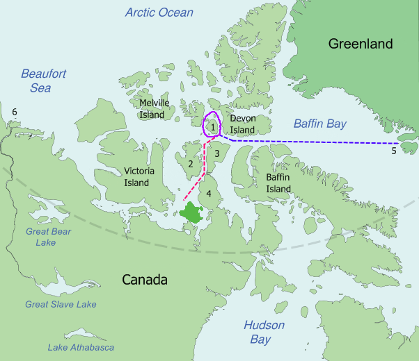
Description: Map of the probable routes taken by Erebus and Terror during Franklin's lost expedition. Disko Bay (5) to Beechey Island, in 1845 Around Cornwallis Island (1), in 1845 Beechey Island down Peel Sound between Prince of Wales Island (2) and Somerset Island (3) and the Boothia Peninsula (4) to near King William Island in 1846 Disko Bay (5) is about 3,200 kilometres (2,000 mi) from the mouth of the MacKenzie River (6).
Title: Franklin's lost expedition map
Credit: Based on Image:King_William_Island.svg, which is a modification by User:Kennonv of images from the CIA World Fact Book, a U.S. government work in the public domain, further modified by User:Finetooth
Author: Finetooth, Kennonv, U.S. Central Intelligence Agency
Usage Terms: Public domain
License: Public domain
Attribution Required?: No
Usos del archivo
Las siguientes páginas enlazan a este archivo:
