
Archivo: Forts at Forks of Ohio
No disponible en mayor resolución.
Forts_at_Forks_of_Ohio.png (621 × 409 píxeles; tamaño de archivo: 66 KB; tipo MIME: image/png)
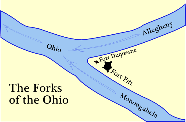
Description: The map places the forts according to the positions of reconstructed elements, such as this bastion of Ft. Duquesne. Self-made map of the Forks of the Ohio (Monongahela, Allegheny and Ohio rivers). Shows Fort Pitt and Fort Duquesne. Outlines of the walls (curtains) of the forts traced from the original plans as published in 19th century histories.
Title: Forts at Forks of Ohio
Credit: Own work
Author: en:User:Tomcool
Usage Terms: Creative Commons Attribution-Share Alike 3.0
License: CC BY-SA 3.0
License Link: http://creativecommons.org/licenses/by-sa/3.0
Attribution Required?: Yes
Usos del archivo
La siguiente página enlaza a este archivo:

Todo el contenido de los artículos de la Enciclopedia Kiddle (incluidas las imágenes) se puede utilizar libremente para fines personales y educativos bajo la licencia Atribución-CompartirIgual a menos que se indique lo contrario.