
Archivo: Fort Davidson Battlefield Missouri
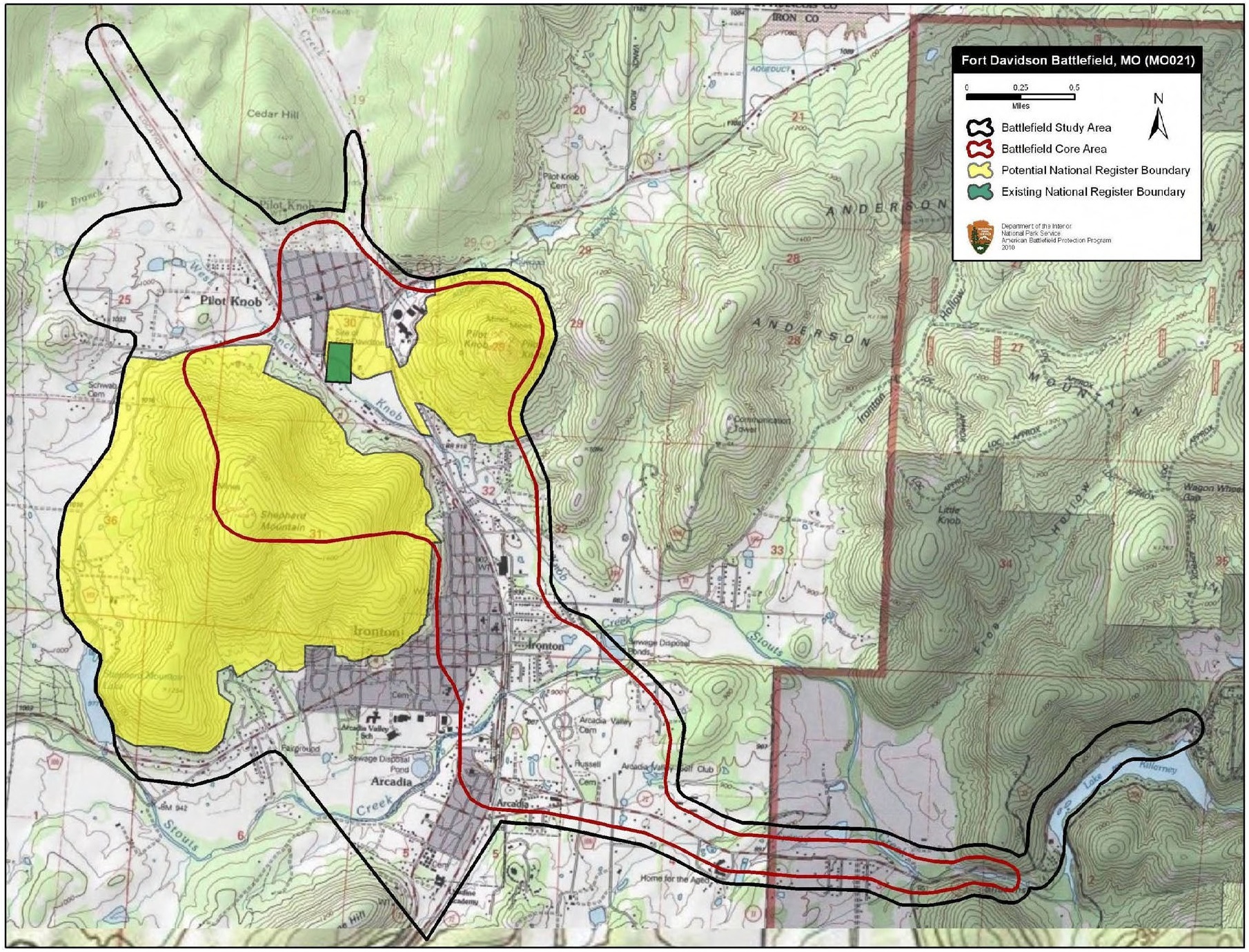
Descripción: Map of battlefield core and study areas. The ABPP expanded the 1993 Study Area boundary significantly. The larger Study Area encompasses the initial Confederate approach from the east to the Shut-ins; the site of the Confederate encampment on the southern side of Shepherd Mountain; Confederate troop movements on and around Shepherd Mountain; Federal troop movements on Pilot Knob; Confederate troop movements above Fort Davidson (made in an attempt to attack Fort Davidson from the north); the sites of the two Confederate encampments north of the town of Pilot Knob between which withdrawing Union troops had to pass under cover of darkness; and the Union route of withdrawal from the fort to the northwest. Because the combatants fought over the same middle ground repeatedly during the two-day battle, the two original CWSAC Core Areas were expanded and merged to create a single Core Area. This new Core Area encompasses areas where fighting took place on either, or both, September 26 and 27. It includes the initial point of contact at the Shut-ins and areas of subsequent engagement in Arcadia and Ironton on the 26th, and the areas of fighting in the gap, on the mountains, and around Fort Davidson on the 27th.
Título: Fort Davidson Battlefield Missouri
Créditos: National Park Service
Autor(a): American Battlefield Protection Program
Términos de Uso: Dominio Público
Licencia: Dominio Público
¿Se exige la atribución?: No
Usos del archivo
La siguiente página enlaza a este archivo:
