
Archivo: Etruscan civilization map
Tamaño de esta previsualización: 493 × 599 píxeles. Otras resoluciones: 197 × 240 píxeles | 994 × 1208 píxeles.
Archivo original (994 × 1208 píxeles; tamaño de archivo: 361 KB; tipo MIME: image/png)
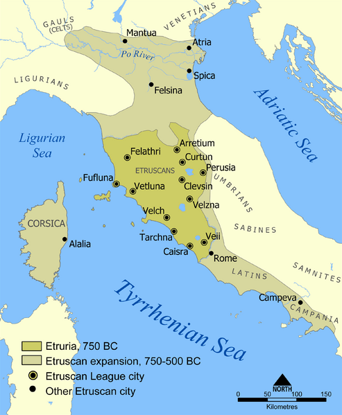
Description: A map showing the extent of Etruria and the Etruscan civilization. The map includes the 12 cities of the Etruscan League and notable cities founded by the Etruscans. The dates on the map are an approximation based on the sources I had. If the article is updated with more accurate dates let me know and I'll modify this map to suit.
Title: Etruscan civilization map
Credit: Based on a map from The National Geographic Magazine Vol.173 No.6 June 1988.
Author: NormanEinstein
Permission: GNU-FDL
Usage Terms: Creative Commons Attribution-Share Alike 3.0
License: CC-BY-SA-3.0
License Link: http://creativecommons.org/licenses/by-sa/3.0/
Attribution Required?: Yes
Usos del archivo
Las siguientes páginas enlazan a este archivo:

Todo el contenido de los artículos de la Enciclopedia Kiddle (incluidas las imágenes) se puede utilizar libremente para fines personales y educativos bajo la licencia Atribución-CompartirIgual a menos que se indique lo contrario.