
Archivo: ElectoralCollege1832

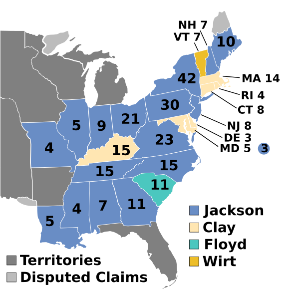
Descripción: Electoral college map for the 1832 United States presidential election.
Título: ElectoralCollege1832
Créditos: This image was adapted from File:ElectoralCollege1828.svg, itself adapted from File:Map of territorial growth 1775.svg and File:ElectoralCollege1964.svg (both based off File:Blank_US_Map.svg) using data from Electoral College Box Scores 1789–1996. Official website of the National Archives. (February 23, 2011), United States Of America: by H.S. Tanner, 1832. Third Edition. File:United_States_1828-1834.png, the original version uploaded by AndyHogan14 and the National Atlas of the United States
Autor(a): Cg-realms (current) AndyHogan14 (original)
Términos de Uso: Dominio Público
Licencia: Dominio Público
¿Se exige la atribución?: No
Usos del archivo
La siguiente página enlaza a este archivo:
