
Archivo: Earth oblateness to scale

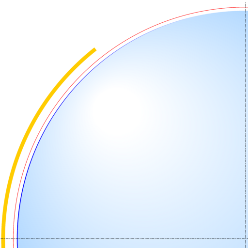
Descripción: Scale drawing of the oblateness of the 2003 IERS reference ellipsoid. The outer edge of the dark blue line is an ellipse with the same eccentricity as that of the Earth, with North at the top. For comparison, the outer edge of the light blue area is a circle of diameter equal to the minor axis (a point on the equator, to its antipode). The red line denotes the Karman line (100 km altitude) and the yellow area, the range of the International Space Station (330-435 km altitude, 51.65-degree orbital inclination).
Título: Earth oblateness to scale
Créditos: Trabajo propio
Autor(a): Cmglee
Términos de Uso: Creative Commons Attribution-Share Alike 3.0
Licencia: CC BY-SA 3.0
Enlace de Licencia: https://creativecommons.org/licenses/by-sa/3.0
¿Se exige la atribución?: Sí
Usos del archivo
La siguiente página enlaza a este archivo:
