
Archivo: Dorian 2019-09-01 1641Z
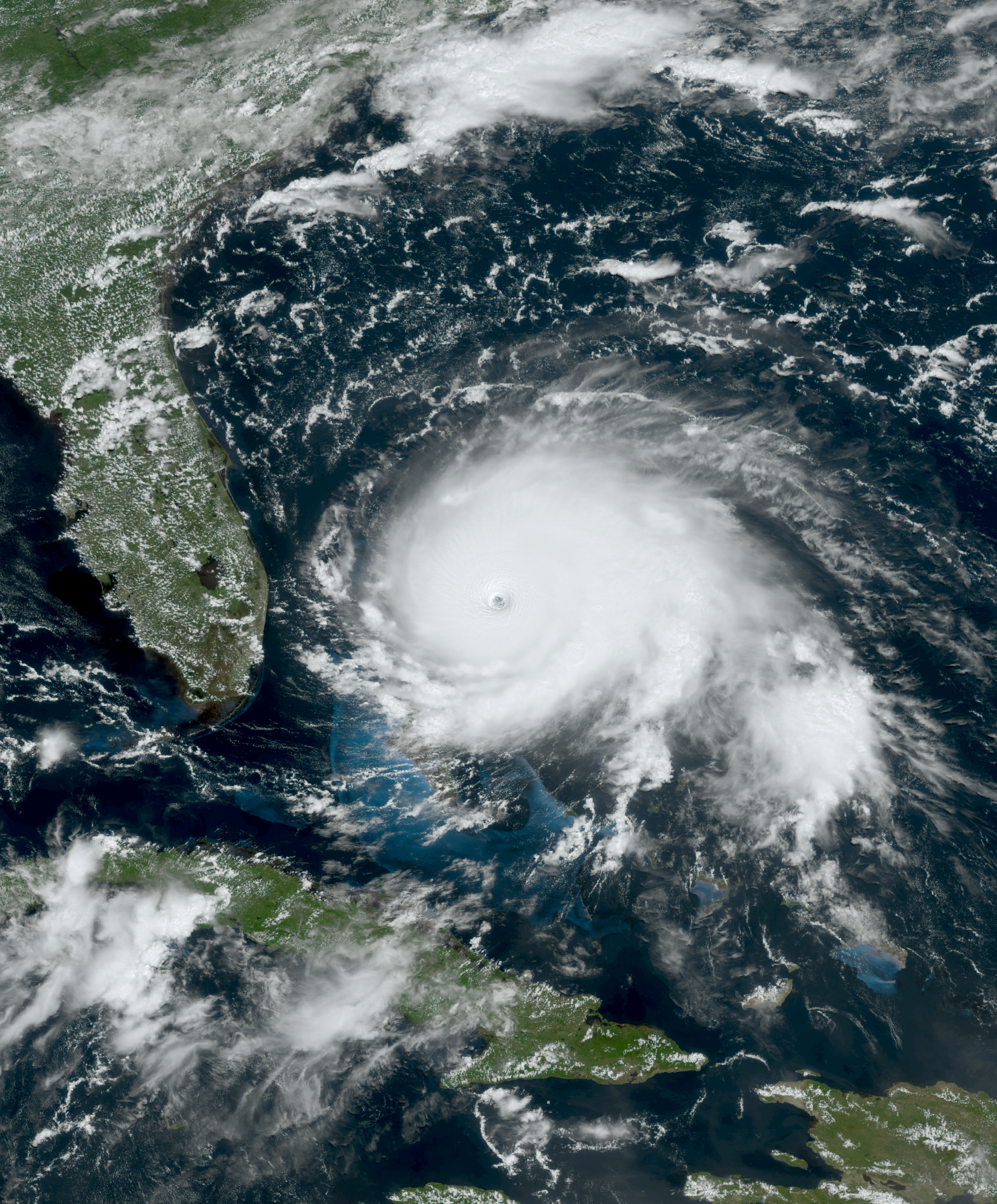
Descripción: This true-color image of Hurricane Dorian was captured on September 1, 2019, at 12:41 P.M. AST (16:41 UTC), by the Advanced Baseline Imager (ABI) instrument flying aboard NOAA's GOES 16 satellite. Dorian was a destructive and extremely powerful hurricane during the slightly above average 2019 Atlantic hurricane season. Dorian would go on and stall over the Bahamas on the day this image was taken into the next day. It would also make landfall in North Carolina and Atlantic Canada days later. When this was captured, Dorian was making landfall in Grand Abaco Island, Bahamas at its peak intensity as a catastrophic Category 5 major hurricane, with winds of 185 mph (298 km/h) (160 knots) on the 1-min Saffir-Simpson scale and had a minimum central pressure of 910 mbar (26.9 inHg).
Título: Dorian 2019-09-01 1641Z
Créditos: AWS S3 Explorer
Autor(a): ABI imagery from NOAA'S GOES-16 Satellite
Términos de Uso: Dominio Público
Licencia: Dominio Público
¿Se exige la atribución?: No
Usos del archivo
La siguiente página enlaza a este archivo:
