
Archivo: Damascus locator map
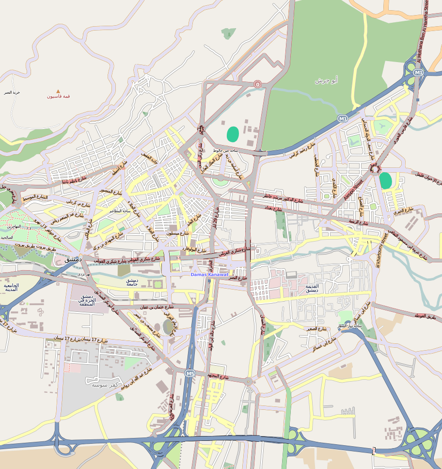
Description: Map of central Damascus — Syria. Geographic limits of the map: N: 33.543° S: 33.4885° W: 36.265° E: 36.3281° This file is licensed under the Creative Commons Attribution-Share Alike 2.0 Generic license. You are free: to share – to copy, distribute and transmit the work to remix – to adapt the work Under the following conditions: attribution – You must give appropriate credit, provide a link to the license, and indicate if changes were made. You may do so in any reasonable manner, but not in any way that suggests the licensor endorses you or your use. share alike – If you remix, transform, or build upon the material, you must distribute your contributions under the same or compatible license as the original. https://creativecommons.org/licenses/by-sa/2.0 CC BY-SA 2.0 Creative Commons Attribution-Share Alike 2.0 truetrue
Title: Damascus locator map
Credit: OpenStreetMap
Author: Dr. Blofeld
Usage Terms: Creative Commons Attribution-Share Alike 2.0
License: CC BY-SA 2.0
License Link: https://creativecommons.org/licenses/by-sa/2.0
Attribution Required?: Yes
Usos del archivo
La siguiente página enlaza a este archivo:
