
Archivo: Cooks Karte von Neufundland
Tamaño de esta previsualización: 615 × 599 píxeles. Otras resoluciones: 246 × 240 píxeles | 1500 × 1462 píxeles.
Archivo original (1500 × 1462 píxeles; tamaño de archivo: 521 KB; tipo MIME: image/jpeg)
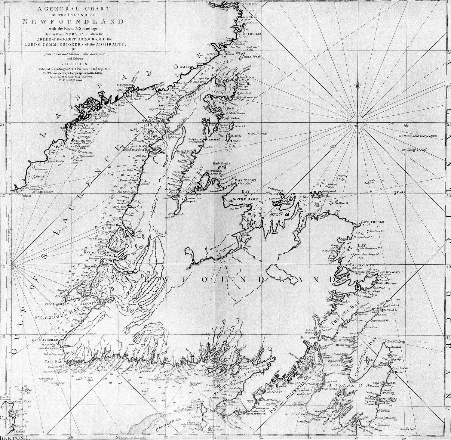
Description: A general chart of the island of Newfoundland. Surveyed by James Cook and Michael Lane, and "publish'd according to Act of Parliament by Thomas Jefferys Geographer to the King, 1775."
Title: Cooks Karte von Neufundland
Credit: originally uploaded to en.wikipedia by Jcmurphy on 23 Apr 2005; copied from "Courtesy of the Centre for Newfoundland Studies, Memorial University of Newfoundland, St. John's, Newfoundland."
Author: Michael Lane and James Cook
Permission: Public domain because of age
Usage Terms: Public domain
License: Public domain
Attribution Required?: No
Usos del archivo
La siguiente página enlaza a este archivo:

Todo el contenido de los artículos de la Enciclopedia Kiddle (incluidas las imágenes) se puede utilizar libremente para fines personales y educativos bajo la licencia Atribución-CompartirIgual a menos que se indique lo contrario.