
Archivo: Columbia
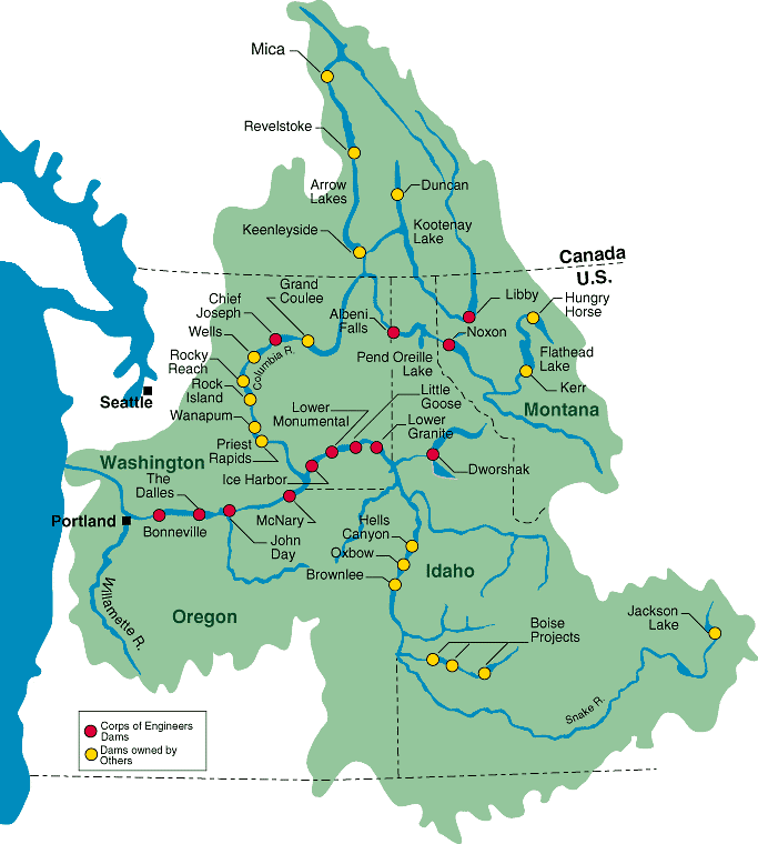
Description: Maps of dams, drainage and estuaries along the Columbia River in North America (USA, Canada). Original caption: The Columbia River carved the Interior Columbia River Basin from the landscape of seven Western states and two Canadian provinces. The river itself flows from its headwaters in British Columbia, Canada through only two states, forming part of the Washington-Oregon border, the vast Interior Columbia River Basin is defined by the area drained by the river and its many tributaries. This 58-million-hectare area (about the size of France) extends roughly from the crest of the Cascade Mountains of Oregon and Washington east through Idaho to the Continental Divide in the Rocky Mountains of Montana and Wyoming, and from the headwaters of the Columbia River in Canada to the high desert of northern Nevada and northwestern Utah.
Title: Columbia
Credit: Primary Source: U.S. Army Corps of Engineers, North Pacific Region (http://www.nwd-wc.usace.army.mil/report/colmap.htm) Secondary source: http://en.wikipedia.org/wiki/Image:Columbia.png
Author: U.S. Government
Usage Terms: Public domain
License: Public domain
Attribution Required?: No
Usos del archivo
Las siguientes páginas enlazan a este archivo:
