
Archivo: Cerro del Plomo route
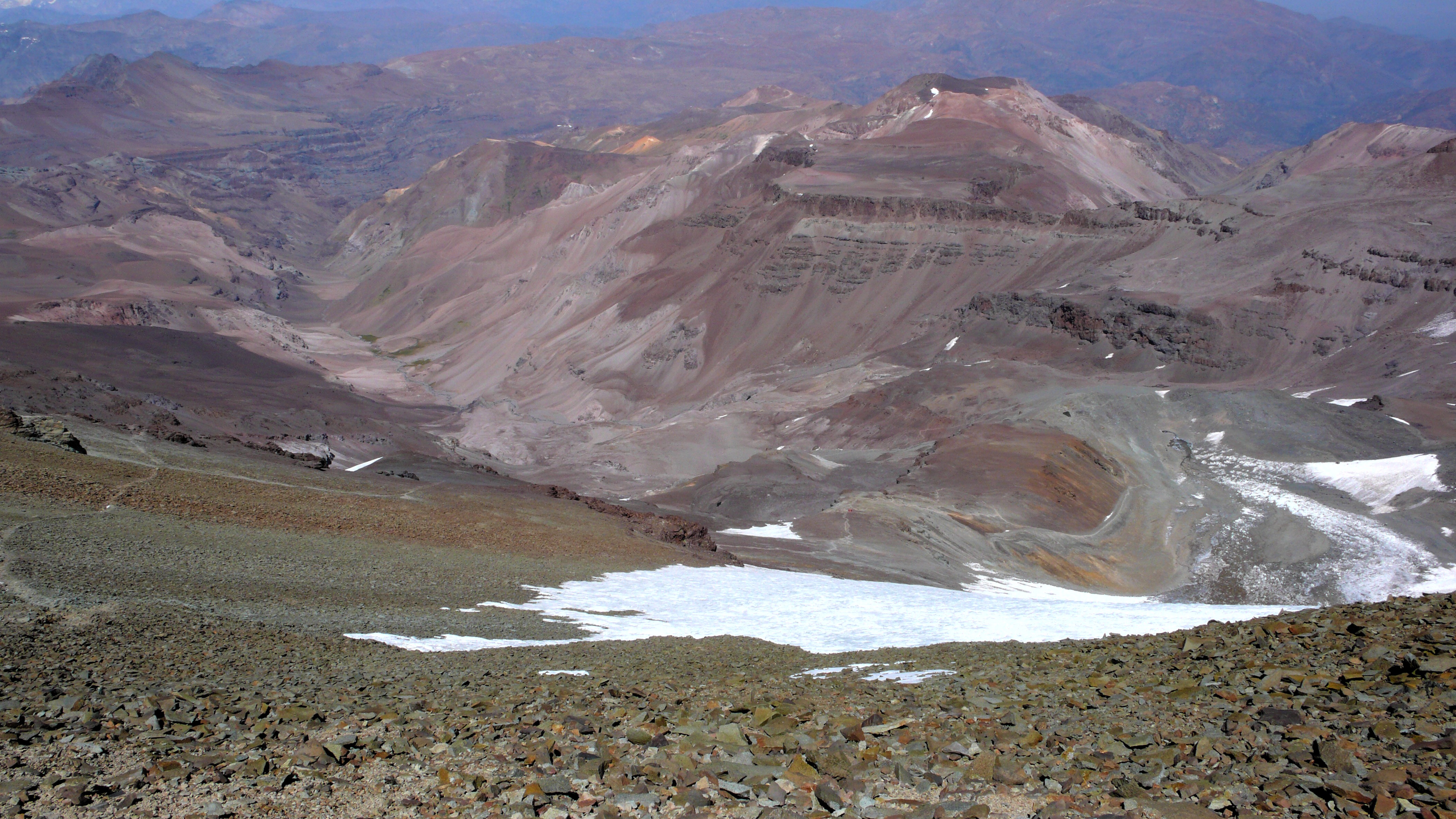
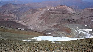
Descripción: Looking south on most of the Cerro del Plomo route. Somewhat to the left, near the greenish spots deep down in the Estero Cepo valley, is the Piedra Numerada base camp (approx. 3,400m). The route then follows this valley to La Hoya (or La Olla; approx. 4,200m), which is hidden by the moraine at the far right of the picture. From this moraine, the track is clearly visible on the picture, going first to the newly rebuilt Refugio Agostini (the red dot near the center of the picture; 4,620m), and then in steep hairpins (mostly hidden) to the easy traverse at the far left. From here it is less than two hours to the summit, with, immediately beyond the Pirca del Inca burial site, a short glacier crossing. El Pintor (approx. 4,200m) can be seen in the background. The Cerro del Plomo (5,424m) is not to be confused with the Nevado El Plomo (6,070m), which lies on the border about 20km to the north-east. (Cf. John Biggar, The Andes — A Guide for Climbers, ISBN 0-9536087-2-7, p. 217; Hermann Kiendler, Die Anden — Vom Chimborazo zum Marmolejo — Alle 6000er auf einen Blick, ISBN 978-3-936740-36-3, pp. 349–352.)
Título: Cerro del Plomo route
Créditos: Trabajo propio
Autor(a): Tijs Michels
Permiso: cc-by-sa-3.0 (attribution required - see below)
Términos de Uso: Creative Commons Attribution-Share Alike 3.0
Licencia: CC BY-SA 3.0
Enlace de Licencia: https://creativecommons.org/licenses/by-sa/3.0
¿Se exige la atribución?: Sí
Usos del archivo
La siguiente página enlaza a este archivo:
