
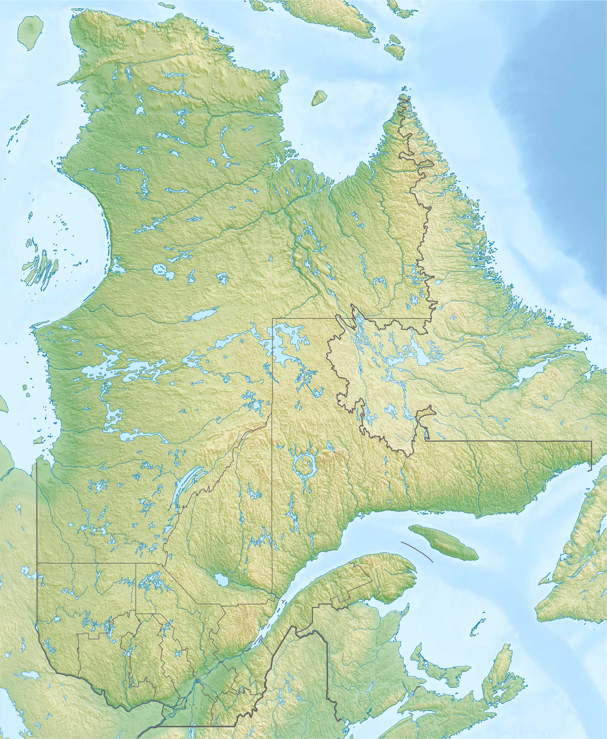
Archivo: Canada Quebec relief location map
Description: Physical location map of Quebec, Canada
Title: Canada Quebec relief location map
Credit: Own work, using File:Canada Quebec location map.svg by NordNordWest. STRM-30 data for the relief
Author: Carport
Permission: This file is licensed under the Creative Commons Attribution-Share Alike 3.0 Unported license. You are free: to share – to copy, distribute and transmit the work to remix – to adapt the work Under the following conditions: attribution – You must give appropriate credit, provide a link to the license, and indicate if changes were made. You may do so in any reasonable manner, but not in any way that suggests the licensor endorses you or your use. share alike – If you remix, transform, or build upon the material, you must distribute your contributions under the same or compatible license as the original. https://creativecommons.org/licenses/by-sa/3.0 CC BY-SA 3.0 Creative Commons Attribution-Share Alike 3.0 truetrue
Usage Terms: Creative Commons Attribution-Share Alike 3.0
License: CC BY-SA 3.0
License Link: https://creativecommons.org/licenses/by-sa/3.0
Attribution Required?: Yes
Usos del archivo
Las siguientes páginas enlazan a este archivo:
- Archipiélago de Mingan
- Bahía de Gaspé
- Cabo Diamant
- Cabo Gaspé
- Cabo Wolstenholme
- Caldera de Misema
- Caldera de Noranda
- Cascadas de Montmorency
- Cataratas Coulonge
- Cataratas de Chaudière
- Cueva de Saint-Léonard
- Estuario del San Lorenzo
- Faro de Cap-des-Rosiers
- Faro de Pointe-au-Père
- Fuerte Senneville
- Isla San Quintín
- Isla de Anticosti
- Isla de Montreal
- Islas de la Magdalena
- Lago Manicouagan
- Lago Osisko
- Lago Saint-Jean
- Lago Saint-Louis
- Monte Caribou
- Península de Ungava
- Puente de Quebec
- Rocher Percé
- Río Betsiamites
- Río Moisie
- Río Pentecôte
- Río Roggan
