
Archivo: Battle of the Pyrenees 1813 Map
No disponible en mayor resolución.
Battle_of_the_Pyrenees_1813_Map.jpg (718 × 600 píxeles; tamaño de archivo: 86 KB; tipo MIME: image/jpeg)
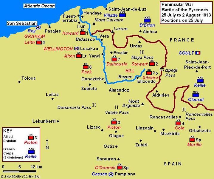
Descripción: Map shows the positions of Anglo-Allied and French units in the Battle of the Pyrenees on 25 July 1813.
Título: Battle of the Pyrenees 1813 Map
Créditos: Trabajo propio
Autor(a): Djmaschek
Términos de Uso: Creative Commons Attribution-Share Alike 4.0
Licencia: CC BY-SA 4.0
Enlace de Licencia: https://creativecommons.org/licenses/by-sa/4.0
¿Se exige la atribución?: Sí
Usos del archivo
La siguiente página enlaza a este archivo:

Todo el contenido de los artículos de la Enciclopedia Kiddle (incluidas las imágenes) se puede utilizar libremente para fines personales y educativos bajo la licencia Atribución-CompartirIgual a menos que se indique lo contrario.