
Archivo: Baltic Tribes c 1200

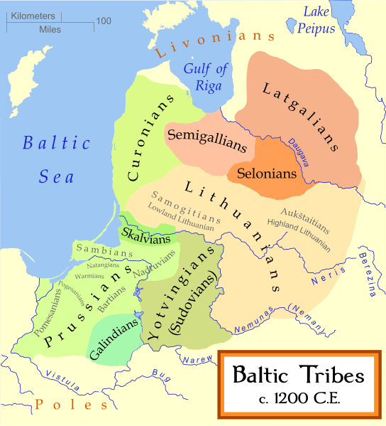
Description: English: A map of the Baltic Tribes, about 1200 AD. The Eastern Balts are shown in brown hues while the Western Balts are shown in green. The boundaries are approximate. This map uses a Mercator projection.
Title: Baltic Tribes c 1200
Credit: Based on a map by Marija Gimbutas, published in The Balts (1963) LCC 63018018. Available at Vaidilute.com. In addition to Gimbutas, other maps were also consulted: "Libiesi Citu Senas Latvijas Cilsu Vidu" (Livonians and other tribes of ancient Latvia 10th - 12th centuries) A map from the Latvijas Enciklopedja Map at Emokykla.LT Another map at Emokykla.LT
Author: MapMaster
Usage Terms: Creative Commons Attribution-Share Alike 3.0
License: CC-BY-SA-3.0
License Link: http://creativecommons.org/licenses/by-sa/3.0/
Attribution Required?: Yes
Usos del archivo
La siguiente página enlaza a este archivo:
