
Archivo: Bagratuni Armenia 1000-en

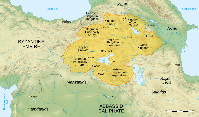
Descripción: English map of Bagratuni Armenia, around the year 1000 AD
Título: Bagratuni Armenia 1000-en
Créditos: Data sources : Background map : NASA Shuttle Radar Topography Mission (SRTM3 v.2) (public domain) Armenia map : George A. Bournoutian (2006) History of the Armenian People_Ancient times to AD 1500.pdf A Concise History of the Armenian People (PDF) (5.o ed.), Costa Mesa: Mazda Publishers, Inc., Map 15 ISBN: 1-56859-141-1. Rivers, some cities : Demis Softwares used : NASA datas edited with Global Mapper 9 (limited version) by the United States Geological Survey (USGS) Demis data edited with Demis Mapper Vectorized with Inkscape Creation Map Tutorial (in french) from Sting Others : UTM map projection WGS84 geodetic system
Autor(a): Sémhur ·✉·✍·
Términos de Uso: Creative Commons Attribution-Share Alike 3.0
Licencia: CC BY-SA 3.0
Enlace de Licencia: https://creativecommons.org/licenses/by-sa/3.0
¿Se exige la atribución?: Sí
Usos del archivo
La siguiente página enlaza a este archivo:
